

Danielle DeAgostini, Thomas Eatchel, Lindsay Eatchel, Steven Eatchel.
This is preliminary information, subject to change, and may contain errors. Any errors in this report will be corrected when the final report has been completed.
The National Transportation Safety Board traveled to the scene of this accident.
Additional Participating Entities:
Federal Aviation Administration / Flight Standards District Office; Salt Lake City, Utah


 Danielle DeAgostini


Lycoming Engines; Phoenix, Arizona
Transportation Safety Board of Canada
Diamond Aircraft
Location: Cedar City, Utah
Accident Number: WPR22FA164
Date and Time: April 23, 2022, 18:48 Local
Registration: N321PF
Aircraft: DIAMOND AIRCRAFT IND INC DA40
Injuries: 4 Fatal
Flight Conducted Under: Part 91: General aviation - Personal
On April 23, 2022, about 1848 mountain daylight time, a Diamond Aircraft, DA 40, N321PF, was destroyed when it was involved in an accident near Cedar City, Utah. The pilot and 3 passengers were fatally injured. The airplane was operated as a Title 14 Code of Federal Regulations Part 91 personal flight.
The operator reported that the pilot rented the airplane with the intent to fly a multi-leg round robin cross county flight from his home base of Spanish Fork Municipal Airport/Woodhouse Field (SPK), Spanish Fork, Utah. The pilot planned route of flight included intermediate stops at Cedar City Regional Airport (CDC), Bryce Canyon Airport (BCE), Canyonlands Regional Airport (CNY), Carbon County Regional Airport/Buck Davis Field (PUC), before returning to SPK.
The operator stated that the airplane departed SPK on the first leg of the flight with about 40 gallons of fuel.
Recorded airport surveillance video at CDC showed the accident airplane land at 1615 hours and taxi to the self-serve fuel pumps. The pilot and passengers disembarked, and the pilot refueled the airplane, adding about 14 gallons of fuel. The pilot and passengers subsequently boarded the airplane and taxied toward the runway.
A pilot rated witness, who was driving down Cedar Canyon (westbound) on State Highway 14, reported that he observed what is believed to be the accident airplane flying up the canyon over the river, about 300 ft above ground level (agl). The witness stated that as the airplane was about to pass over their position, it turned left and then right, and that the maneuvers were quick and more like a rocking motion. The witness added that propeller appeared to be under power and not windmilling.
A second witness, who was traveling on State Highway 14 near the accident site, reported that they observed an airplane believed to be the accident airplane flying on an easterly heading, over the highway, about 200-300 ft above the ground (agl). The witness stated that other than being low, the airplane did not appear to be in distress, however; his vehicle windows were up, and he could not hear the airplane’s engine. After the airplane passed over their position, he looked in the mirror and saw the airplane “bank really hard to the south, back across the highway” as if the airplane were trying to turn around in the narrow canyon. The witness stated that at that point, the airplane’s wings appeared to be almost vertical and the airplane “didn’t look like it had enough speed to pull off that maneuver.”
First responders later located the airplane wreckage while responding to a vegetation fire.
Examination of the accident site revealed that the airplane impacted mountainous terrain along the southern edge of a canyon about 7 miles southeast of the CDC. The airplane came to rest inverted, on a magnetic heading of about 289°, at an elevation of 6,583 ft mean sea level. The first identified point of contact (FIPC) was a tall tree that had damaged limbs near the top of the tree. The debris path was oriented on a magnetic heading of about 294° and was about 150 ft in length from the FIPC to main wreckage. All major structural components of the airplane were located throughout the debris path The wreckage was recovered to a secure location for further examination.

Aircraft and Owner/Operator Information
Aircraft Make: DIAMOND AIRCRAFT IND INC
Registration: N321PF
Model/Series: DA40
Aircraft Category: Airplane
Amateur Built:
Operator: Operating Certificate(s) Held: None
Operator Designator Code:
Meteorological Information and Flight Plan
Conditions at Accident Site: VMC
Condition of Light: Day
Observation Facility, Elevation: KCDC,5590 ft msl
Observation Time: 18:53 Local
Distance from Accident Site: 7 Nautical Miles
Temperature/Dew Point: 9°C /-8°C
Lowest Cloud Condition: Few / 9500 ft AGL
Wind Speed/Gusts, Direction: 8 knots / , 20°
Lowest Ceiling:
Visibility: 10 miles
Altimeter Setting: 30.1 inches Hg
Type of Flight Plan Filed: None
Departure Point: Cedar City, UT
Destination: Bryce Canyon, UT (BCE)
Wreckage and Impact Information
Crew Injuries: 1 Fatal
Aircraft Damage: Destroyed
Passenger Injuries: 3 Fatal
Aircraft Fire: None
Ground Injuries:
Aircraft Explosion: None
Total Injuries: 4 Fatal
Latitude, Longitude: 37.64785,-112.97382
Aircraft crashed under unknown circumstances in mountainous terrain and post impact fire.
Date: 24-APR-22
Time: 00:48:00Z
Regis#: N321PF
Aircraft Make: DIAMOND
Aircraft Model: DA40
Event Type: ACCIDENT
Highest Injury: FATAL
Total Fatal: 4
Flight Crew: 1 fatal
Pax: 3 fatal
Aircraft Missing: No
Damage: DESTROYED
Activity: SIGHT SEEING
Flight Phase: MANEUVERING (MNV)
Operation: 91
City: CEDAR CITY
State: UTAH
Those who may have information that might be relevant to the National Transportation Safety Board (NTSB) investigation may contact them by email witness@ntsb.gov, and any friends and family who want to contact investigators about the accident should email assistance@ntsb.gov. You can also call the NTSB Response Operations Center at 844-373-9922 or 202-314-6290.
Thomas Eatchel
SALT LAKE CITY – The National Transportation Safety Board’s preliminary report of April’s fatal plane crash in Iron County hints at odd maneuvers before the crash.
According to the two witnesses, they noticed the plane making maneuvers that seemed abnormal.
The first witness said that the plane was about to pass him on State Highway 14 but turned quickly and was in a “rocking motion.” He added that the propeller looked underpowered and was not working right.
The second witness supported these events and saw the plane “bank really hard to the south, back across the highway” as if it was trying to turn around in the canyon. He noticed the plane having speed issues with the wings looking upright and didn’t look fast enough for the turn.
Both witnesses said the plane was about 200 to 300 feet above the ground when it attempted the turn.
The NTSB report corroborates the timeline of pilot Steven Eatchel and his three passengers, Lindsay Eatchel, Thomas Eatchel, and Danielle Deagostini, leaving for a sightseeing trip starting in Spanish Fork, to Cedar City, then to Bryce Canyon and other locations before returning to Spanish Fork.
The plane crashed upside down into a tree in the canyon, causing it to break apart, according to the report.
The NTSB said this is a preliminary report, and details might change as the investigation continues.

CEDAR CITY – The Utah County Sheriff's Office announced Sunday that one of four people killed in a Saturday plane crash near Cedar City was a longtime deputy with the department.
Family members said Steven Eatchel was flying with his wife Lindsey Eatchel, brother Thomas Eatchel and Tom's girlfriend Danielle DeAgostini, to Cedar City to visit another brother.
According to the Iron County Sheriff's Office, the four took off from the Spanish Fork Municipal Airport Saturday afternoon, touched down in Cedar City for a little over an hour, then took off again with plans for a sightseeing tour over Zion National Park.
Just a few minutes after takeoff, the plane crashed five miles outside Cedar City.
Pilot Steven Eatchel has been with the Utah County Sheriff's Office for 12 years, working in courts and corrections at the jail, said Utah County Sheriff's Sgt. Spencer Cannon.
"When you first hear it, it's like you almost just shake your head and say, 'This can't be real.' And it takes a minute for it to settle in," Cannon said. He said he had just talked to Steven Eatchel three days ago and described the deputy as always working with a smile.
Cannon said the community was well-served by Steven Eatchel, who was committed to his job and was well liked.
"He would work most recently at the Utah County Security Center, when I would see him just a few days ago, at the front desk where the public comes in and he greets them," Cannon explained. "And if I'm going out there to meet media or something, he's there, and I'll chat with him for a couple of minutes."
Those casual chats are now memories shared by deputies who worked with Steven Eatchel. Cannon said everybody is hurting and still having to go to work as they process the loss.
Family posted that the Steven and Lindsay Eatchel leave behind four young children.
"It's a tragedy that's going to stick with us, and the tragedy's compounded by the fact that he's got four kids that he's left behind now, that they've left behind — he and his wife Lindsay," Cannon said. "And It's hard to imagine what it must be like for the rest of the family who are now caring for those children, and how do you explain this to them that mom and dad aren't coming home again? And that's a hard pill to swallow."
In addition to the children losing their parents, the Eatchel family lost two sons/brothers, plus the loss experienced by Lindsay Eatchel and Danielle DeAgostini's families — all in an instant.
The Utah County law enforcement community is processing losing their co-worker and friend, Cannon expressed.
"There will be a hole there to fill and that feeling is going to take a while to go away, especially for those that work more closely with Steve," Cannon said. "You don't get over it. You don't find closure. I think you find a way to work your way through it and learn how to live with it."
As the Federal Aviation Administration and National Transportation Safety Board investigate that crash, family members have set up GoFundMe* fundraisers for the families of Lindsay and Steven Eatchel, as well as for Thomas Eatchel.
*KSL.com does not assure that the money deposited to the account will be applied for the benefit of the persons named as beneficiaries. If you are considering a deposit to the account, you should consult your own advisors and otherwise proceed at your own risk.
Lindsay and Steven Eatchel
(Photo: Utah County Sheriff's Office)

IRON COUNTY, Utah — The four people killed Saturday in a small plane crash east of Cedar City have been identified by the Iron County Sheriff‘s Office.
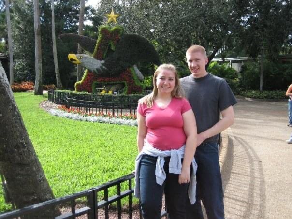
The victims were pilot Steven Eatchel and wife Lindsay Eatchel of Springville, Thomas Eatchel of Heber City, and Danielle DeAgostini of Sandy.
Steven Eatchel was a deputy with the Utah County Sheriff’s Office. Lindsay Eatchel was his wife.
“Deputy Eatchel has worked for the Sheriff’s Office for nearly 12 years and was currently assigned in corrections,” a UCSO statement says. “Steve and Lindsay leave behind four children.
“The Utah County Sheriff’s Office expresses its sincerest condolences to the Eatchel family. His kind manner and ever present smile will be missed.”
The crash
The call came in at 6:47 p.m. Saturday reporting a fire about five miles east of Cedar City, on State Route 14. Iron County Sheriff’s deputies responded, as did Utah Highway Patrol Troopers and Color County Fire personnel.
“Upon arrival, Sheriff deputies made their way toward what they believed to be a fire, and discovered the burning remains of a downed aircraft,” a statement from the Sheriff’s Department says.
“Paramedics from Gold Cross Ambulance, Cedar Fire personnel and members of the Iron County Search & Rescue were dispatched, and arrived on the scene to assist.”
The pilot and three passengers of the Diamond DA40 Diamond Star aircraft were found deceased.
Planned route
Iron County Sheriff officials say the aircraft left Spanish Fork municipal Airport at approximately 2:45 p.m., and arrived at Cedar City Regional Airport at about 4:10 p.m.
After an approximate 2.5 hour layover, the aircraft took off at approximately 6:38 p.m. for a sightseeing tour of Zion National Park, and was following State Route 14, headed east, before radar communication lost the aircraft at 6:42 p.m.
“On scene, deputies stated, based off debris, aircraft orientation and damage to foliage, it appeared the aircraft crashed heading west from an easterly direction,” the ICSO update says. “Investigators from the Iron County Sheriff’s Office, along with investigators from the Federal Aviation Administration and National, National Transportation Safety Board will conduct a scene investigation to determine the cause of the crash.
“Again, the Iron County Sheriff’s Office would like to extend our deepest sympathy to the family and friends os of those who lost their lives in this tragic event.”

Thomas Eatchel

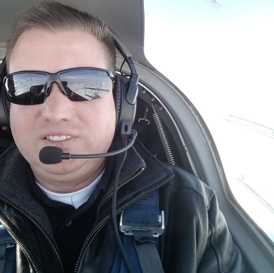
The pilot of the plane that crashed in Iron County on April 23, 2022 was identified as Deputy Steven Eatchel of Springville. Eatchel was a deputy with the Utah County Sheriff's Office who officials said worked at the Utah County Jail.
(Photo: Utah County Sheriff's Office)
IRON COUNTY, Utah — Officials have identified the four people killed in a small plane crash Saturday evening near Cedar City.
Around 7 p.m., authorities received a report of a fire near State Route 14, about five miles east of Cedar City. When police and fire crews responded, they found the burning remains of a Diamond DA40 Diamond Star aircraft.
Four people were on board, and they were all pronounced dead at the scene.
The Iron County Sheriff’s Office identified the victims as Steven Eatchel of Springville, Lindsay Eatchel of Springville, Thomas Eatchel of Heber City, and Danielle DeAgostini of Sandy.
Steven Eatchel, the pilot, was a deputy with the Utah County Sheriff’s Office, Sgt. Spencer Cannon told FOX 13 News. He worked in the county jail and had been with the sheriff’s office since 2010. He and Lindsay Eatchel were married, and they leave behind four children.
"The Utah County Sheriff's Office expresses its sincerest condolences to the Eatchel family. His kind manner and ever present smile will be missed," a statement from the sheriff's office read.
According to a press release from the Iron County Sheriff's Office, the plane had flown from the Spanish Fork Municipal Airport to the Cedar Regional Airport Saturday afternoon. The group then took off at 6:38 p.m. for a sightseeing tour of Zion National Park, but radar communication was lost four minutes later. It was flying east along SR-14, but officials said the "debris, aircraft orientation, and damage to foliage" at the crash scene indicated that the plane was going west when it hit the ground.
The sheriff's office, the Federal Aviation Administration and the National Transportation Safety Board are investigating the cause of the crash.
"[T]he Iron County Sheriff’s Office would like to extend our deepest sympathy to the family and friend of those who lost their life in this tragic event," the press release read.


CEDAR CITY, Utah — Four people were killed when a small airplane crashed in Cedar Canyon a few miles east of Cedar City on Saturday evening, authorities said.
Iron County Sheriff’s Lt. David Mitchell said the initial call came in shortly before 7 p.m. as a report of a fire in the trees just to the south of state Route 14, at approximately mile marker 6.
When firefighters reached the scene, they found the burning remains of a downed aircraft, Mitchell said.
The Diamond DA40 Diamond Star was occupied by four people, all of whom were pronounced dead at the scene, he added.
“Law enforcement is attempting to identify the plane’s occupants at this time,” stated a news release issued by Iron County Sheriff’s Office shortly after midnight on Sunday. “Our thoughts and prayers go out to all family members and friends of the deceased.”
Just after 11 p.m., firefighters and other responders had wrapped up the recovery operation and headed back down the canyon to Cedar City.
Mitchell said the state medical examiner’s office has been notified of the incident, as have investigators with the Federal Aviation Administration and the National Transportation Safety Board.
Other details, including the specific airplane involved and its flight path, have not yet been released, but Mitchell said additional information would be forthcoming as it becomes available.
Those responding to the incident included Iron County Sheriff’s deputies, Iron County Search and Rescue personnel, Utah Highway Patrol troopers, firefighters and crews from Cedar City Fire Department and Color Country Fire and Gold Cross Ambulance paramedics.


4 large adults in a 180ph plane, maybe refueled in Cedar City then flying east into quickly rising terrain, easy to line up the holes in the cheese, so sad...every week a bad plane crash killing families...
ReplyDeleteLooks to be a fairly heavily loaded plane, high terrain and flying towards mountains.
ReplyDeleteMy thoughts exactly! Overloaded.
DeleteAnd a too late climbing, low speed turnback leading to a stall like that crash last summer in Telluride, CO killing newlyweds. (adding to my 2 post above)
DeleteThey gained only 1000’ in about 9 miles. That route requires a climb to over 10,000’ MSL (or 4500’ altitude gain) in just 14 miles (320ft/nm gradient, so 640 fpm at 120kts gs). Kind of a head scratcher. Maybe they thought they were flying down I-15? Or maybe they didn’t realize they didn’t have the performance until there was no room to turn around.
ReplyDeleteAs a pilot whose flown in this area frequently, I agree with everything you said, except I can tell you there is no way to mistake UT-14 with I-15. I-15 is 4 lanes, wide, with a big center median and follows the flat inviting terrain south of the airport. They already followed I-15 down when they landed at KCDC so they would have been familiar. UT-14 is 2 lanes, narrow, windy. no median and goes directly up into steep uninviting terrain. Also, they flew over the I-15 and the town of Cedar City to get to UT-14, so there is no way they'd miss I-15. If you look at a satellite view you'll see what I mean.
DeleteCompletely agree in a just world, but I've seen people do some pretty dumb things. You're probably right, though. I'm still baffled as to why they went that direction without understanding the required climb gradient and performance of the aircraft. Was it a case of wanting to stay low and sightsee, or as I said earlier, they didn't realize it until it was too late to turn around or circle for altitude.
DeleteI didn't see it posted, so here's the METAR for KCDC just after the accident: KCDC 240053Z AUTO 02008KT 10SM FEW095 09/M08 A3010 RMK AO2 SLP177 T00941083
So figure a PA of 5457 and a DA of 6022 at takeoff.
Based on the AFM from Diamond's website, a DA40 at an assumed MTOW at that density altitude is nominally going to cruise climb at 76KIAS/480FPM at takeoff, 420FPM at the accident altitude, barely 260FPM by the time they got to 9000'MSL and by 10,000' just over 200FPM. Add 10-15 knots to get TAS, unsure what winds were in that canyon at that time. The GS recorded by Flightradar24 (taken with a grain of salt) was 100kts, so per the AFM, their rate of climb would have been less than optimal cruise climb. A climb at Vy might have gotten them sufficient altitude, but still not great at that assumed weight.
The plateau that UT-14 runs to tops out at 9800', but there is a saddle a
few miles to the south (along the flightpath to Zion) that is only about 9200'. A person would have to do some pretty fancy low-flying and have local knowledge to pick that out.
It's sad to see CFIT in any circumstance, but this just seems so avoidable.
One more observation: On the flight down from Provo, they went up to 13,000' (an 8650' gain). It took them almost 40 minutes and 63nm to do so, at an average climb rate of 216FPM and a gradient of 137'/NM. During that, they passed through 10,000' (a 5650' gain) in 23 minutes and 36nm, for an average climb rate of 245FPM and a 157'/NM gradient to that point. Both rates well short of the 320'/NM needed to go over the US-14 route from KCDC.
DeleteFlying down I-15 at 13,000' was surely not needed as both Dog Valley and Scipio Passes are only just over 6000'. Was this a test of the aircraft's capabilities?
The interesting thing is that the groundspeed for the fatal flight during the climb was almost exactly the same as that of the earlier flight. In this case, they should have done the math and figured out they weren't going to meet the required gradient. The only wild-guess unknowns are the actual weight of the aircraft and the indicated airspeed. Taking a look at Google Earth when they made that first right-turn corner on UT-14, seeing that steeply rising terrain ahead may have been a true "oh s**t" moment. At their altitude, they had maybe 1/3 of a mile diameter to turn around, even if they were following one canyon wall or the other.
If you want Center flight following for that route, you have to be pretty high. Gets you out of the mountain wave as well for a more comfortable ride.
DeleteThey weren't on with flight following on the flight from Provo to Cedar. The ADS-B log shows that they were squawking 1200 the entire time.
DeleteSeems odd that some pilots residing near majestic terrain don't fully comprehend the danger of flying up through rising terrain.
ReplyDeleteMaybe Utah plane rental transactions should include giving a wallet size "don't let your pilot fly you up through rising terrain" card to the passengers who are going along. With everyoner aboard made aware of the danger, the likelihood of making a decision to turn away before it is too late might be greatly improved.
Do it as the reverse side image on playing cards, along with the issuing FBO's name and logo. And also give out a card pack to transient pilots purchasing fuel. That Telluride newlywed crash happened after buying fuel...
Do something that might instill that awareness into ALL of the participant's minds who go aloft over terrain in the cabins of piston aircraft. FAA, AOPA, aircraft manufacturers and others could promote the campaign.
Something as simple as a mountain checkout from a competant (experienced) flight instructor wouldn't hurt. When I flew out of KGXY I did a mountain checkout. A new CFI was in the back. We flew to Leadville, CO. It's one of the most useful checkout's that I've ever done.
Delete“Check Density Altitude” is commonly heard on the ATIS at high and hot airports throughout the west. In many airplanes with normally aspirated engines the rate of climb will be negative at a certain temperature and gross weight. Even in turbocharged airplanes the rate of climb is minimal at high density altitude.
ReplyDeletethe agent for 1PF "Registration Owner RRSF LLC" is Marc Robins of UT. FFA pilot records show a "Certificate: PRIVATE PILOT, Date of Issue: 6/2/2012 for MARC SUNE ROBINS, PLEASANT GROVE UT 84062-2069, County: UTAH, Country: USA."
ReplyDeleteOwner Robins wasn't aboard.
DeleteDAlt concerns, Overloaded after full fuel? Airplane has a 780lb useful load. Full fuel, 4 full size adults, DA issue? Looked to be razor thin up at higher elevation, and a Normally Asp. engine. There are a lot of links in this chain! RIP!
ReplyDeleteLooking at their track log is baffling. The terrain ahead was thousands of feet higher than they were and they just went straight into it.
ReplyDeleteThe high terrain east of Cedar City is a deathtrap for most GA aircraft. I wouldn't go anywhere near the route they were taking unless I was already at at least 12,000 feet. At the last ADS-B reported pressure altitude of 6,400 feet, they would have been barely 500 feet above the lowest terrain and surrounded by peaks 3,000+ feet higher on most sides. Also, in the late afternoon when this flight happened, the winds really whip through those canyons causing heavy turbulence and strong up and down drafts.
ReplyDeleteThe AF/D has a clearly worded warning for KCDC:
Recommend pilots circle airport for altitude before departing eastbound due to fast rising terrain and hi density altitude. Turbulence likely in vicinity of mountains and passes.
Flying directly to the east after takeoff makes zero sense.
I tried to fly up the valley with X-Plane 11 (the ground mesh is pretty accurate) Well you can't do it at the altitude registered on Flight Aware and FR24. Now before you cut me down as a flight sim pilot, I have over 10,500 hours Military, ATP, Airline. CFI II etc real time since 1982.
ReplyDeleteNo need to apologize. X-Plane and the Microsoft flight sim series (and P3D) have been approved for training time in flight schools for years now (but not official logbook time). See FAR 61.129(i)(1) for more info.
DeleteI use XPlane to fly into airports I've never been to all the time and fly in weather that I would normally avoid (the result is almost always the same). We had a snowstorm here (Four Corners) once so I turned local weather on and flew a C172 IFR from KFMN almost to KCEZ. There's nothing more sobering than to watch a C172 depart controlled flight, pop out of the bottom of the clouds at 200', hit the ground, and not be able to do anything about it. So, now I know that what I used to tell my kids when they hurt themselves is true, don't do that...
DeleteIf the pilot had used X-plane while planning this trip we'd have a lot less tragedy.
Delete
ReplyDeleteturned east → 76° @ Latitude: 37.671 | Longitude: -113.0382 per flightaware. Altitude: 2034 meters or 6676 ft. per https://www.gps-coordinates.net/
Not to pile on here, but the previous flight from Provo to Cedar didn't really show particularly great airmanship. Altitude was all over the place ranging from 10,500 up to 13,100 back down to 10,600 then up to 11,200, never quite level nor at a proper 91.159 hemispheric VFR altitude, and (ironically based on the accident flight) quite a bit higher than they needed to be for the terrain. The descent into Cedar wasn't well planned with a high descent rate up to 2,382 fpm at one point. And finally, pilots are supposed to fly left traffic for runway 02, but despite being well positioned west of the extended runway 02 upwind centerline to enter the correct left downwind for runway 02 at this busy non-towered airport, they instead crossed to the east side of runway 02 to fly an improper right downwind to 02. Considering how busy the pattern can be at Cedar due to all the flight training at the airport, flying the opposite non-standard pattern is both inconsiderate and risky. They also entered the downwind well above pattern altitude and dropped into the downwind at around 2,000 fpm, only reaching pattern altitude when there were about abeam the 02 numbers, which is another risky move, especially in a low-wing aircraft when you won't have great visibility of aircraft below you in the pattern.
ReplyDeletethis makes me wonder if he was distracted from other people in the aircraft or showing off or somewhere in between
DeleteNo Pilot wants to show off very poor airmanship.
DeleteSteven just got his private pilot cert less than a year ago and interestingly had a first class medical so maybe he wanted to go the airline route in the future:
ReplyDeleteSTEVEN JOHN EATCHEL
Medical Information:
Medical Class: First Medical Date: 9/2021
Certificate: PRIVATE PILOT
Date of Issue: 9/6/2021
Ratings:
PRIVATE PILOT
AIRPLANE SINGLE ENGINE LAND
Thomas had a student pilot cert as well as a first class medical from over a decade ago:
THOMAS G EATCHEL
Medical Information:
Medical Class: First Medical Date: 9/2001
Certificate: STUDENT PILOT
Date of Issue: 9/6/2001
No pilot record was found for Danielle or Lindsay.
Maybe some added training requirements for mountain flying and related aircraft performance should be added into all training syllabus. Density altitude and terrain dont seem to register in many pilots .Also four seats doesn't mean you can fill them. Fuel tanks can't always be topped off. No Real overwhelming technical factors in planning this kind of flight but he still missed the obvious.
ReplyDeleteApproximate crash coordinates 37.6478, -112.9739 - obtained by comparing drone crash site photos with Utah State Route 14 around mile marker 6 on google maps - any corrections are welcome if this is the wrong spot.
ReplyDeleteYou got a good match. Map-pinning your coordinates:
Deletehttp://maps.google.com/maps?t=k&q=loc:37.6478+-112.9739
Keeping a copy of this map-pin format for next time will allow anyone to replace the coordinates and make new pinning display links. :-)
Altitude: 2221 meters or 7286.745 feet. per https://www.gps-coordinates.net/map/country/US
DeleteHere is the location looking south from the street:
ReplyDeletehttps://www.google.com/maps/@37.6490944,-112.9730324,3a,75y,215.97h,92.2t/data=!3m6!1e1!3m4!1s5PcDnWtI4aGlbYqRj6O8Xg!2e0!7i13312!8i6656
Here is the correct location of the accident:
https://www.google.com/maps/place/37%C2%B038'53.9%22N+112%C2%B058'28.1%22W/@37.6483241,-112.9747363,116m/data=!3m1!1e3!4m6!3m5!1s0x0:0x767a64e63d5232ef!7e2!8m2!3d37.6482974!4d-112.9744601
Your location is 230 feet NW of the two uniquely tall trees that are seen in photos immediately adjacent to the wreckage.
DeleteCompare this link's pin to the photos, again:
http://maps.google.com/maps?t=k&q=loc:37.6478+-112.9739
And this shrub in the trail path is a key locator near the two tall trees:
http://maps.google.com/maps?t=k&q=loc:37.648195+-112.973863
Align to the same shrub in KR's photo, here:
https://blogger.googleusercontent.com/img/b/R29vZ2xl/AVvXsEhVkHM66PRb4QffyceT5aPbVIteL3NgdHlbdDYKD3zczsHlEX-anyng77lFeI69SSu9mPxWz20n3lyqjBiRgDabqEBXb1S-9nJBOY6uZsEwPtTaNeIDUv3VEi65VPtDquYLNYUGec_1r4Cr6q5SYaNwZqvWFgPEbXdterrIZkriD8CQYlJ4HU_QKFJiTw/w640-h360/KathrynsReport.jpg
You're off by about 115' WSW of the actual location.
DeleteHere is the correct location of the accident.
https://www.google.com/maps/place/37%C2%B038'52.3%22N+112%C2%B058'24.6%22W/@37.6478481,-112.9736438,58m/data=!3m1!1e3!4m6!3m5!1s0x0:0x9cb6bdc8163eed47!7e2!8m2!3d37.6478466!4d-112.9735066
Figure 1 of the preliminary report shows the left wing at the pinned location of the very first poster's Wednesday, April 27, 2022 at 1:05:00 AM EDT coordinates, main wreckage is 30' adjacent:
Deletehttp://maps.google.com/maps?t=k&q=loc:37.6478+-112.9739
Tip of the hat goes to that Wednesday, April 27, 2022 at 1:05:00 AM EDT first poster's coordinates worked out for the wreckage location and the response highlighting the shrub in the trail at Figure 1's "North" label and two unique trees as key location points for correlation.
in the daytime photos of the crash site, where is the plane? Did they already remove it? there's nothing there.
ReplyDeleteThe aircraft disintegrated and burned to ashes.
DeleteEvery pilot should practice box canyon turns. Full throttle, pitch up for 1.3 times Vso, full flaps, 45 degree turn into the wind from the windward side of the canyon.
ReplyDelete…or learning how to avoid situations where a box canyon turn is necessary?
DeleteThat too, but better to know it but not need it than the opposite.
Delete"learning how to avoid situations where a box canyon turn is necessary"
DeleteThat's the thought process of a non-instrument-rated pilot's improper decisions to begin and to continue a flight under visual flight rules into instrument meteorological conditions, which result in controlled flight into terrain.
Train often = Box canyon turns and VFR encounter with instrument meteorological conditions. Fly safely...
Good point. And, know your aircraft: the plane likely didn’t suddenly and unexpectedly fail to meet its performance capabilities. A loaded plane at that density altitude has a KNOWN gradient of climb. Don’t expect it to exceed it.
DeleteShouldn’t that turn be made from the turn from the leeward side? That would be from the downwind to the upwind, making for a slower ground speed and tighter turn.
DeleteI meant make the turn into the wind, if that means the leeward side of the canyon and not the windward, then I stand corrected. I was looking at this diagram when naming the sides: https://www.researchgate.net/figure/Schematic-diagram-of-flow-and-dispersion-of-pollutants-in-a-street-canyon-showing-the_fig1_331373348
DeleteI live in Cedar City and have flown up Cedar Canyon many times.... always started out by circling and climbing to 10,000 MSL before even thinking about entering the canyon. None of what he did makes sense.
ReplyDeleteThat is how I would do it too....which is why I cant imagine what he was thinking. Even if you had no mountain flying training, one would think its kinda obvious big mountain = must fly higher
DeleteI know, but spend a little time browsing here on KR and you'll see that there are many joyriders with an apparent lack of understanding and comprehending physics (science!) out there. Perhaps not the case here...
DeleteCondolences to the families and friends.
I pulled the April 24 0030Z CTAF tapes for KCDC from LiveATC and it is clear that the pilot intentionally flew the eastbound route directly into the mountains based on their last transmission shortly after departure:
ReplyDelete"Cedar City Traffic, uh 321PF departing the flight pattern to the east, Cedar City Traffic"
The only thing east of Cedar City is high mountainous terrain.
Almost suicidal. I don't get it.
ReplyDeleteNTSB preliminary report is out
ReplyDeletehttps://data.ntsb.gov/carol-repgen/api/Aviation/ReportMain/GenerateNewestReport/104989/pdf
NTSB Prelim is out. Flying into the canyon didn't have altitude and tried to turn around. Nothing so far beyond what was already expected
ReplyDeletehttps://data.ntsb.gov/carol-repgen/api/Aviation/ReportMain/GenerateNewestReport/104989/pdf
Local "flightseeing" outing. Got down to 300 AGL before turning.
DeleteOperators renting out aircraft in mountain regions could remind renters not to fly through drainages below ridgelines unless they are going downslope through widening terrain. Verbalize the warning and add a standalone "Pilot agrees" checkbox with "initials here" on the rental paperwork to acknowledge commitment to that specific advisory statement.
Shouldn't have to tell a pilot that, but if the pilot's spouse was within earshot when the operator made that clear to the renting pilot or looked at the paperwork, the downslope only cautionary instruction would probably have saved four lives.
Insurers should step up and require the warning and checkbox in standard rental agreement boilerplate. No downside to doing so and worth a try.
Rental paperwork? I'm pretty sure anyone wanting to rent a plane has to have a checkout flight with the rental operation's CFI prior to the flight, which would presumably cover these sort of concerns much better than some paperwork you have the pilot complete.
DeleteAren't you also pretty sure at this point that the pilot's checkout flight with the rental operation's CFI presumably didn't prevent the unwise upslope flight.?
DeleteDon't ignore the rest of the suggestion about how verbalizing the warning and initialing the "Pilot agrees" checkbox during the activities performed at the FBO counter would have created an opportunity for the spouse and pax to become aware by hearing and seeing.
Three of the people who perished only became aware of the unwise pilot action moments before death. An in-airplane discussion might have taken place much earlier with someone saying:
"Didn't they have you agree at the counter not to fly upslope?"
All UT residents. One wonders their combined regional flight experience for all acft? and for the acft owner to rent his $200K plus DA 40 to four large adults for a fight into mountainous terrain with multiple destinations?
ReplyDeleteas noted above, PIC "Certificate: PRIVATE PILOT, Date of Issue: 9/6/2021" and brother who may have been up front had a "Certificate: STUDENT PILOT
Date of Issue: 9/6/2001."