Tuesday, January 04, 2022

Loss of Control in Flight: Cessna 120, N76646; accident occurred January 03, 2022 at Cable Airport (KCCB), Upland, San Bernardino County, California


Aviation Accident Final Report - National Transportation Safety Board

The National Transportation Safety Board did not travel to the scene of this accident. 

Additional Participating Entity: 
Federal Aviation Administration / Flight Standards District Office; Riverside, California

Investigation Docket - National Transportation Safety Board:

NextGen Flight Academy Inc


Location: Upland, California 
Accident Number: WPR22LA072
Date and Time: January 3, 2022, 12:05 Local
Registration: N76646
Aircraft: Cessna 120
Aircraft Damage: Substantial
Defining Event: Loss of control in flight
Injuries: 1 Minor
Flight Conducted Under: Part 91: General aviation - Personal

Analysis

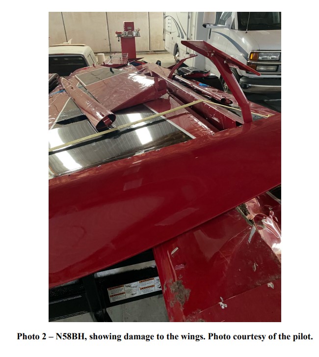
The pilot of the tail wheeled-equipped airplane reported that, he was on an approach to land at an uncontrolled airport behind two helicopters. An airport surveillance video showed the accident airplane flying over the runway about 20 seconds after a helicopter was in a slow hover taxi adjacent to the runway. The pilot reported that he saw the helicopter and decided to land long to maintain separation. He added that while on short final, he saw a helicopter “cross” the runway, so he increased engine power to full and attempted a go-around. About one-third of the way down the length of the runway, the airplane encountered the helicopter’s downwash, and the airplane entered an uncommanded steep right bank. The pilot applied opposite aileron, but he was not able to maintain control of the airplane. Subsequently, the airplane impacted right of the runway and sustained substantial damage to the right wing and fuselage. The pilot reported that there were no preaccident mechanical malfunctions or failures with the airplane that would have precluded normal operation.

According to Federal Aviation Administration Advisory Circular No. 90-23G, Aircraft Wake Turbulence, “pilots should avoid taxiing or flying within a distance of three rotor diameters of a helicopter hovering or in a slow hover taxi, as the downwash can contain high wind speeds.

Probable Cause and Findings

The National Transportation Safety Board determines the probable cause(s) of this accident to be:
The pilot’s loss of airplane control during a go-around as it encountered wake turbulence from a slow hover taxiing helicopter.

Findings

Aircraft (general) - Attain/maintain not possible
Personnel issues Aircraft control - Pilot
Environmental issues Wake turbulence - Effect on equipment

Factual Information

History of Flight

Landing Loss of control in flight (Defining event)

Pilot Information

Certificate: Commercial; Flight instructor 
Age: 24, Male
Airplane Rating(s): Single-engine land
Seat Occupied: Right
Other Aircraft Rating(s): None 
Restraint Used: Unknown
Instrument Rating(s): Airplane 
Second Pilot Present:
Instructor Rating(s): Airplane single-engine; Instrument airplane
Toxicology Performed:
Medical Certification: Class 1 Without waivers/limitations
Last FAA Medical Exam: March 30, 2017
Occupational Pilot: No
Last Flight Review or Equivalent: March 4, 2021
Flight Time: (Estimated) 1107.7 hours (Total, all aircraft), 18.8 hours (Total, this make and model), 1007.5 hours (Pilot In Command, all aircraft), 175.9 hours (Last 90 days, all aircraft), 52.9 hours (Last 30 days, all aircraft), 4.3 hours (Last 24 hours, all aircraft)

Aircraft and Owner/Operator Information

Aircraft Make: Cessna 
Registration: N76646
Model/Series: 120 
Aircraft Category: Airplane
Year of Manufacture: 1946 
Amateur Built:
Airworthiness Certificate: Normal
Serial Number: 11086
Landing Gear Type: Tailwheel 
Seats: 2
Date/Type of Last Inspection: Unknown
Certified Max Gross Wt.: 1450 lbs
Time Since Last Inspection: 
Engines: 1 Reciprocating
Airframe Total Time: 
Engine Manufacturer: Continental
ELT: 
Engine Model/Series: C85
Registered Owner: 
Rated Power: 85 Horsepower
Operator: 
Operating Certificate(s) Held: None

Meteorological Information and Flight Plan

Conditions at Accident Site: Visual (VMC) 
Condition of Light: Day
Observation Facility, Elevation: KCCB,1439 ft msl 
Distance from Accident Site: 0 Nautical Miles
Observation Time: 12:35 Local 
Direction from Accident Site: 307°
Lowest Cloud Condition: Clear 
Visibility: 10 miles
Lowest Ceiling: None
Visibility (RVR):
Wind Speed/Gusts: 4 knots /
Turbulence Type
Forecast/Actual:
None / None
Wind Direction: 210° 
Turbulence Severity Forecast/Actual: N/A / N/A
Altimeter Setting: 30.16 inches Hg
Temperature/Dew Point: 15°C / -10°C
Precipitation and Obscuration: No Obscuration; No Precipitation
Departure Point: Riverside, CA (KRAL)
Type of Flight Plan Filed: None
Destination: Upland, CA 
Type of Clearance: None
Departure Time: 11:34 Local 
Type of Airspace: Class G

Airport Information

Airport: CABLE CCB 
Runway Surface Type: Asphalt
Airport Elevation: 1443 ft msl
Runway Surface Condition: Dry
Runway Used: 24 
IFR Approach: None
Runway Length/Width:
3863 ft / 75 ft VFR 
Approach/Landing: Full stop

Wreckage and Impact Information

Crew Injuries: 1 Minor
Aircraft Damage: Substantial
Passenger Injuries:
Aircraft Fire: On-ground
Ground Injuries: 
Aircraft Explosion: None
Total Injuries: 1 Minor 
Latitude, Longitude: 34.111611,-117.68738


Location: Upland, California
Accident Number: WPR22LA072
Date and Time: January 3, 2022, 12:05 Local
Registration: N76646
Aircraft: Cessna 120
Injuries: 1 Minor
Flight Conducted Under: Part 91: General aviation - Personal

Aircraft and Owner/Operator Information

Aircraft Make: Cessna
Registration: N76646
Model/Series: 120 
Aircraft Category: Airplane
Amateur Built:
Operator: 
Operating Certificate(s) Held: None
Operator Designator Code:

Meteorological Information and Flight Plan

Conditions at Accident Site: 
Condition of Light:
Observation Facility, Elevation: KCCB, 1439 ft msl 
Observation Time: 12:35 Local
Distance from Accident Site: 0 Nautical Miles
Temperature/Dew Point: 15°C /-10°C
Lowest Cloud Condition: Clear
Wind Speed/Gusts, Direction: 4 knots / , 210°
Lowest Ceiling: None
Visibility: 10 miles
Altimeter Setting: 30.16 inches Hg 
Type of Flight Plan Filed:
Departure Point:
Destination:

Wreckage and Impact Information

Crew Injuries: 1 Minor
Aircraft Damage: Substantial
Passenger Injuries:
Aircraft Fire: On-ground
Ground Injuries: 
Aircraft Explosion: None
Total Injuries: 1 Minor
Latitude, Longitude: 34.111611,-117.68738 

Cessna 172S Skyhawk SP, N173DC: Incident occurred January 03, 2022 at Reid-Hillview County Airport (KRHV), Santa Clara County, California

Federal Aviation Administration / Flight Standards District Office; San Jose, California

Aircraft incurred a tail strike on landing.  

Acadian Air LLC


Date: 03-JAN-22
Time: 19:56:00Z
Regis#: N173DC
Aircraft Make: CESSNA
Aircraft Model: 172
Event Type: INCIDENT
Highest Injury: NONE
Aircraft Missing: No
Damage: UNKNOWN
Activity: INSTRUCTION
Flight Phase: LANDING (LDG)
Operation: 91
City: SAN JOSE
State: CALIFORNIA

Nose Over: American Champion 8GCBC Scout, N58BH; accident occurred January 01, 2022 in Jordan Valley, Malheur County, Oregon


Aviation Accident Final Report - National Transportation Safety Board

The National Transportation Safety Board did not travel to the scene of this accident. 

Additional Participating Entity: 
Federal Aviation Administration / Flight Standards District Office; Boise, Idaho

Investigation Docket - National Transportation Safety Board:

Bob Hannah Aviation LLC


Location: Jordan Valley, Oregon
Accident Number: WPR22LA074
Date and Time: January 1, 2022, 12:00 Local 
Registration: N58BH
Aircraft: AMERICAN CHAMPION AIRCRAFT 8GCBC
Aircraft Damage: Substantial
Defining Event: Nose over/nose down 
Injuries: 1 None
Flight Conducted Under: Part 91: General aviation - Personal

Analysis

The pilot of the tailwheel equipped airplane reported that during the takeoff roll on snow-covered desert terrain, the airplane broke through the snow, and nosed over. The vertical stabilizer and rudder were substantially damaged. The pilot reported that there were no preaccident mechanical failures or malfunctions with the airplane that would have precluded normal operation.

Probable Cause and Findings

The National Transportation Safety Board determines the probable cause(s) of this accident to be:
The pilot’s decision to takeoff on remote snow covered terrain which, resulted in a nose-over.

Findings

Personnel issues Decision making/judgment - Pilot
Aircraft Directional control - Not attained/maintained
Personnel issues Aircraft control - Pilot
Environmental issues Snow/slush/ice covered surface - Effect on operation

Factual Information

History of Flight

Takeoff Nose over/nose down (Defining event)

Pilot Information

Certificate: Commercial 
Age: 65, Male
Airplane Rating(s): Single-engine land; Single-engine sea; Multi-engine land
Seat Occupied: Front
Other Aircraft Rating(s): Airship
Restraint Used: 4-point
Instrument Rating(s): Airplane 
Second Pilot Present: No
Instructor Rating(s): None 
Toxicology Performed:
Medical Certification: Class 2 With waivers/limitations 
Last FAA Medical Exam: November 9, 2021
Occupational Pilot: No 
Last Flight Review or Equivalent: October 29, 2021
Flight Time: 10325 hours (Total, all aircraft), 2000 hours (Total, this make and model), 10325 hours (Pilot In Command, all aircraft), 30 hours (Last 90 days, all aircraft), 10 hours (Last 30 days, all aircraft), 0 hours (Last 24 hours, all aircraft)

Aircraft and Owner/Operator Information

Aircraft Make: AMERICAN CHAMPION AIRCRAFT
Registration: N58BH
Model/Series: 8GCBC 
Aircraft Category: Airplane
Year of Manufacture: 2015 
Amateur Built:
Airworthiness Certificate: Normal 
Serial Number: 568-2015
Landing Gear Type: Tailwheel
Seats: 2
Date/Type of Last Inspection: September 2, 2021 Annual 
Certified Max Gross Wt.: 2150 lbs
Time Since Last Inspection: 673 Hrs 
Engines: 1 Reciprocating
Airframe Total Time: at time of accident
Engine Manufacturer: LYCOMING
ELT: C126 installed
Engine Model/Series: O-360-C1G
Registered Owner: 
Rated Power: 180 Horsepower
Operator: On file
Operating Certificate(s) Held: None

Meteorological Information and Flight Plan

Conditions at Accident Site: Visual (VMC)
Condition of Light: Day
Observation Facility, Elevation: KEUL,2429 ft msl 
Distance from Accident Site: 23 Nautical Miles
Observation Time: 10:56 Local 
Direction from Accident Site: 70°
Lowest Cloud Condition: Clear
Visibility: 10 miles
Lowest Ceiling: None 
Visibility (RVR):
Wind Speed/Gusts: 3 knots /
Turbulence Type Forecast/Actual: None / None
Wind Direction: 40° 
Turbulence Severity Forecast/Actual: N/A / N/A
Altimeter Setting: 30.37 inches Hg 
Temperature/Dew Point: -8°C / -12°C
Precipitation and Obscuration: No Obscuration; No Precipitation
Departure Point: Jordan Valley, OR 
Type of Flight Plan Filed: None
Destination: Caldwell, ID 
Type of Clearance: None
Departure Time: 
Type of Airspace: Class E

Airport Information

Airport: Succor Creek Airstrip NA
Runway Surface Type:
Airport Elevation: 3274 ft msl 
Runway Surface Condition: Ice; Snow
Runway Used: 
IFR Approach: None
Runway Length/Width:
VFR Approach/Landing: None

Wreckage and Impact Information

Crew Injuries: 1 None
Aircraft Damage: Substantial
Passenger Injuries:
Aircraft Fire: None
Ground Injuries: 
Aircraft Explosion: None
Total Injuries: 1 None 
Latitude, Longitude: 43.516389,-117.14(est)


Location: Jordan Valley, Oregon
Accident Number: WPR22LA074
Date and Time: January 1, 2022, 12:00 Local
Registration: N58BH
Aircraft: AMERICAN CHAMPION AIRCRAFT 8GCBC
Injuries: 1 None
Flight Conducted Under: Part 91: General aviation - Personal

Aircraft and Owner/Operator Information

Aircraft Make: AMERICAN CHAMPION AIRCRAFT
Registration: N58BH
Model/Series: 8GCBC
Aircraft Category: Airplane
Amateur Built:
Operator: On file
Operating Certificate(s) Held: None
Operator Designator Code:

Meteorological Information and Flight Plan

Conditions at Accident Site: VMC
Condition of Light: Day
Observation Facility, Elevation: KEUL, 2429 ft msl 
Observation Time: 10:56 Local
Distance from Accident Site: 23 Nautical Miles 
Temperature/Dew Point: -8°C /-12°C
Lowest Cloud Condition: Clear 
Wind Speed/Gusts, Direction: 3 knots / , 40°
Lowest Ceiling: None 
Visibility: 10 miles
Altimeter Setting: 30.37 inches Hg 
Type of Flight Plan Filed: None
Departure Point: Jordan Valley, OR 
Destination: Caldwell, ID

Wreckage and Impact Information

Crew Injuries: 1 None
Aircraft Damage: Substantial
Passenger Injuries: 
Aircraft Fire: None
Ground Injuries:
Aircraft Explosion: None
Total Injuries: 1 None
Latitude, Longitude: 43.516389,-117.14 (est)

Airbus A319-132, N829AW: Incident occurred January 03, 2022 at John Glenn Columbus International Airport (KCMH), Columbus, Ohio

Federal Aviation Administration / Flight Standards District Office; Columbus, Ohio

Aircraft blew a tire on landing damaging gear door and hydraulic line. 

American Airlines


Date: 03-JAN-22
Time: 20:00:00Z
Regis#: N829AW
Aircraft Make: AIRBUS
Aircraft Model: A319
Event Type: INCIDENT
Highest Injury: NONE
Aircraft Missing: No
Damage: UNKNOWN
Activity: COMMERCIAL
Flight Phase: LANDING (LDG)
Operation: 121
Aircraft Operator: AMERICAN AIRLINES
Flight Number: AAL1492
City: COLUMBUS
State: OHIO

Pilatus PC-12/45, N601HT: Fatal accident occurred January 03, 2022 at Northern Colorado Regional Airport (KFNL), Fort Collins, Larimer County, Colorado

Federal Aviation Administration / Flight Standards District Office; Denver, Colorado

Aircraft taxied for departure and pilot became ill while on the runway and transported to a local hospital.

CIGI Direct Insurance Services Inc 
Consumer Insurance Services Inc 
Consumer Insurance Group Inc


Date: 03-JAN-22
Time: 20:35:00Z
Regis#: N601HT
Aircraft Make: PILATUS
Aircraft Model: PC12
Event Type: ACCIDENT
Highest Injury: FATAL
Total Fatal: 1
Flight Crew 1 fatal
Pax 1 no injuries
Aircraft Missing: No
Damage: UNKNOWN
Activity: PERSONAL
Flight Phase: TAXI (TXI)
Operation: 91
City: FORT COLLINS
State: COLORADO

Those who may have information that might be relevant to the National Transportation Safety Board (NTSB) investigation may contact them by email witness@ntsb.gov, and any friends and family who want to contact investigators about the accident should email assistance@ntsb.gov. You can also call the NTSB Response Operations Center at 844-373-9922 or 202-314-6290.

Mooney M20C, N6796N: Fatal accident occurred December 31, 2021 in Marana, Pinal County, Arizona

This is preliminary information, subject to change, and may contain errors. Any errors in this report will be corrected when the final report has been completed. 

The National Transportation Safety Board traveled to the scene of this accident. 

Additional Participating Entities: 
Federal Aviation Administration / Flight Standards District Office; Scottsdale, Arizona 
Lycoming Engines; Phoenix, Arizona


Location: Marana, Arizona 
Accident Number: WPR22FA073
Date and Time: December 31, 2021, 13:30 Local 
Registration: N6796N
Aircraft: Mooney M20C 
Injuries: 1 Fatal
Flight Conducted Under: Part 91: General aviation - Personal

On December 31, 2021, about 1330 mountain standard time, a Mooney M20C, N6796N, was destroyed when it was involved in an accident near Marana, Arizona. The pilot was fatally injured. The airplane was operated as a Title 14 Code of Federal Regulations Part 91 personal
flight.

Family of the pilot reported that he had departed Marana Regional Airport (AVQ), Marana, Arizona, on December 31, 2021, with an intended destination of French Valley Airport (F70), Murrieta/Temecula, California. Flight Service was notified by concerned family that the pilot had not arrived at the French Valley Airport and was 5 hours overdue. The Federal Aviation Administration (FAA) issued an Alert Notice (ALNOT) shortly after. The airplane wreckage was located by a Search and Rescue air unit the morning of January 4, 2022. There are no known witnesses to the accident sequence.

Examination of the accident site revealed that the airplane impacted open desert terrain about 56 miles northwest of the Marana Regional Airport at an elevation of 2,162 ft mean sea level. The wreckage debris path was about 960 ft. in length, and oriented on a heading of about 308°. All major structural components were observed throughout the debris path.

The AVQ airport’s automated weather observation station reported that, at 1335 mountain standard time, the wind was from 080° at 8 knots, visibility of 10 statute miles, ceiling broken at 3800 ft agl, overcast at 9000 ft agl, temperature of 19°C and dew point temperature of 10°C, altimeter setting of 29.54 inches of mercury.


Aircraft and Owner/Operator Information

Aircraft Make: Mooney
Registration: N6796N
Model/Series: M20C
Aircraft Category: Airplane
Amateur Built:
Operator: On file 
Operating Certificate(s) Held: None
Operator Designator Code:

Meteorological Information and Flight Plan

Conditions at Accident Site: 
Condition of Light: Day
Observation Facility, Elevation: KAVQ, 2031 ft msl 
Observation Time: 13:35 Local
Distance from Accident Site: 
Temperature/Dew Point: 19°C /10°C
Lowest Cloud Condition: 
Wind Speed/Gusts, Direction: 8 knots / , 80°
Lowest Ceiling: Broken / 3800 ft AGL
Visibility: 10 miles
Altimeter Setting: 29.54 inches Hg 
Type of Flight Plan Filed: None
Departure Point:  Marana, AZ 
Destination: Temecula, CA (F70)

Wreckage and Impact Information

Crew Injuries: 1 Fatal 
Aircraft Damage: Substantial
Passenger Injuries: 
Aircraft Fire: None
Ground Injuries: 
Aircraft Explosion: None
Total Injuries: 1 Fatal 
Latitude, Longitude: 32.691664,-112.12789 (est)

Those who may have information that might be relevant to the National Transportation Safety Board (NTSB) investigation may contact them by email witness@ntsb.gov, and any friends and family who want to contact investigators about the accident should email assistance@ntsb.gov. You can also call the NTSB Response Operations Center at 844-373-9922 or 202-314-6290.


Randy K. Donnarumma
~


A pilot was found dead on Monday afternoon a few days after their plane crashed within the Tohono O’odham Nation.

Lauren Reimer, a spokesperson for the Pinal County Sheriff's Office, told The Arizona Republic on Tuesday that the single-engine plane left Marana Airport about 11:30 a.m. on December 31 and was enroute to Riverside, California, shortly before crashing.

Law enforcement found the pilot, who was dead, and the plane wreckage about 3:30 p.m. Monday. 

Reimer said weather appeared to be a factor in the crash and that the National Transportation Safety Board would continue the investigation.

Multiple agencies, including the Pinal County Sheriff’s Office, the Arizona Department of Public Safety, the Tohono O’odham Police Department and the Air Force Rescue Coordination Center, took part in the search, Reimer added.