
The National Transportation Safety Board traveled to the scene of this accident.
Additional Participating Entities:
Federal Aviation Administration / Flight Standards District Office; Grand Rapids, Michigan
Federal Aviation Administration / Accident Investigation Division AVP-100
Textron Aviation; Wichita, Kansas
Honeywell Aerospace; Phoenix, Arizona
N290KA LLC
Location: Boyne City, Michigan
Accident Number: CEN22FA032
Date and Time: November 15, 2021, 12:45 Local
Registration: N290KA
Aircraft: Beech E-90
Injuries: 2 Fatal
Flight Conducted Under: Part 91: General aviation - Business
On November 15, 2021, about 1245 eastern standard time, a Beech E-90, N290KA, was destroyed when it was involved in an accident near Boyne City, Michigan. The airline transport pilot and passenger sustained fatal injuries. The airplane was operated as a Title 14 Code of Federal Regulations Part 91 business flight.
A review of preliminary air traffic control (ATC) information revealed that the airplane departed Oakland County International Airport (PTK), Pontiac, Michigan, at 1150 on an instrument flight rules (IFR) flight plan and climbed to 16,000 ft mean sea level (msl). The airplane was enroute to Boyne City Municipal Airport (N98), Boyne City, Michigan. The airplane descended toward N98 and the pilot was cleared for the RNAV GPS Runway 27 approach.
While on the final approach course, the airplane’s groundspeed gradually slowed from 129 to 88 knots over a period of one minute and the last recorded location showed the airplane was 3.3 nautical miles east of the Runway 27 threshold, about 1,500 ft msl (800 ft above ground level), and slightly left of the approach course. The airplane subsequently impacted the ground about 600 ft west of the last recorded location. Broken tree limbs indicated the airplane was in a steep descent of about 70° while on a west heading.
Two witnesses located about ¼ mile southeast of the accident site heard the airplane fly overhead, followed by a loud thud. The witnesses observed very heavy sleet with low visibility conditions for about 10 minutes, before and after the accident time. The sleet had a high liquid content and would melt quickly after ground impact. An Airman’s Meteorological Information (AIRMET) for icing was valid for the accident location.
Initial examination revealed the entire airplane was present at the accident site and no anomalies were noted with the airplane’s flight controls that would have precluded normal operation. The airplane was retained for further examination.
Aircraft and Owner/Operator Information
Aircraft Make: Beech
Registration: N290KA
Model/Series: E-90
Aircraft Category: Airplane
Amateur Built:
Operator:
Operating Certificate(s) Held: None
Operator Designator Code:
Meteorological Information and Flight Plan
Conditions at Accident Site: IMC
Condition of Light: Day
Observation Facility, Elevation: KMGN,677 ft msl
Observation Time: 12:35 Local
Distance from Accident Site: 13 Nautical Miles
Temperature/Dew Point: 2°C /1°C
Lowest Cloud Condition: Scattered / 1200 ft AGL
Wind Speed/Gusts, Direction: 3 knots / , 360°
Lowest Ceiling: Broken / 2400 ft AGL
Visibility: 10 miles
Altimeter Setting: 29.95 inches Hg
Type of Flight Plan Filed: IFR
Departure Point: Pontiac, MI (PTK)
Destination: Boyne City, MI (N98)
Wreckage and Impact Information
Crew Injuries: 2 Fatal
Aircraft Damage: Destroyed
Passenger Injuries:
Aircraft Fire: None
Ground Injuries:
Aircraft Explosion: None
Total Injuries: 2 Fatal
Latitude, Longitude: 45.204687,-84.907979 (est)
Those who may have information that might be relevant to the National Transportation Safety Board (NTSB) investigation may contact them by email witness@ntsb.gov, and any friends and family who want to contact investigators about the accident should email assistance@ntsb.gov. You can also call the NTSB Response Operations Center at 844-373-9922 or 202-314-6290.
Corbin Dennis Kennedy
April 30, 2000 - November 15, 2021
~

Kenneth D. Yott
July 14, 1960 - November 15, 2021
~
Corbin's obituary
Corbin Dennis Kennedy taken too soon from us on Monday November 15th in a tragic plane accident Corbin was 21 years old, born on April 30th 2000 to Scott P Kennedy (Pilot) and Kimberly D Patton (Flight Attendant) both aviation loving parents, and a few years later was gifted with his twin sister's, Kaylee and Camryn. Corbin's love for his family was overwhelming, and so was his Passion for life. He was actively working toward becoming a professional pilot and he loved to be around airplanes. Corbin was also an avid fisherman and loved being out On the water. He lived every day to the absolute fullest, taking advantage of everything life had to offer him. Corbin is survived by his father Scott Kennedy his mother Kimberly Patton, sisters Kaylee and Camryn. His girlfriend Isabella, many more family and friends.
He had a heart of gold and deeply touched the hearts of every person he met. He left a piece of him in all that new him, always there if you ever needed a hand or help Corbin was there to help he would say, I wish I had more hours in my days. I have so much to do l need more hours in my days. Corbin, I hope your days are long and you can fly with the angles and can do the things you need to do. You will forever be in our hearts sweet boy. You will be missed all the days of our lives.
An aviation scholarship has been set up in Corbin's memory so that hopefully someone else can continue on his dreams. A celebration of life will be held in January in lieu of a service.
YOTT, KENNETH D. of Pontiac; November 15, 2021; age 61; Beloved father of Ashley (Nicholas) Michalski, Justine Yott and Lauren Yott; Significant other of Ambria "Ebony" Harris; Mother of his children Diana Yott; Brother of Cynthia (Frank Ferry) Yott and David (Amy) Yott; Dear grandfather of Ava, Jaxon and Ivy.
Mr. Yott was a pilot. He worked at Pathfinder Aircraft Maintenance and co-founded Jet Tech. He was a member of Word of Faith International Christian Center and was a veteran of the United States Army.
Funeral Services will be held on Tuesday, November 23, 2021 at 10:00 a.m. at the Riverside Chapel, Simpson-Modetz Funeral Home, 5630 Pontiac Lake Road, Waterford. The family will receive friends at the funeral home on Monday from 2 to 8 p.m. Memorials may be made to the 101st Flight.

At 1:28 p.m., the Federal Aviation Administration (FAA) reported an airplane that went off radar near the Boyne Valley/Melrose Township area, according to Charlevoix County Sheriff Chuck Vondra.
The Charlevoix County Sheriff's Office, along with the Boyne City Police Department, Michigan State Police, Michigan Department of Natural Resources, Melrose Township Fire Department, Boyne Valley Township Fire Department, Boyne Valley EMS and Boyne City EMS all responded to the last known area the airplane was reported.
After searching the densely wooded location, the airplane was located by a Michigan State Police helicopter responding to the scene from Lansing, said Vondra.
The deceased are pilot Kenneth Daniel Yott, 61, of Pontiac, and his passenger Corbin Dennis Kennedy, 21, of Howell. They were flying to Boyne City Municipal Airport when their Beechcraft E90 King Air crashed into the wooded area west of Romanik Road in Melrose Township. Both Yott and Kennedy were located in the airplane and were deceased when found. The families of the victims have been notified, according to a press release from the sheriff's office.
As of 9 p.m. on Monday, the sheriff's office also reported that the FAA and National Transportation Safety Board have been contacted and are responding to the scene of the crash.
This is the second plane crash to occur in the past three days in Charlevoix County. On Saturday, November 13, a fatal plane crash on Beaver Island left four dead, including the pilot. An 11-year-old girl is the lone survivor in that accident.
See More → https://www.petoskeynews.com
Corbin Dennis Kennedy


So very saddened to learn of the news of this incident. May Corbin and Kenneth Rest In Peace, Always. Prayers and Thoughts Always to the families and friends of both.
ReplyDeleteLast ADSBEX return showed 89kts descended through 1400' at 470fpm on heading for KN98 RWY27 (KN98 is 660' MSL). That is just 3 knots above the Vmca redline of a C90 King Air. Vref should have been at least 100 knots and they were at 112 knots descending through 1625' at 690fpm just 32 seconds prior. Totally stable flight up to that point. Whatever went wrong went wrong quick. RIP to both lost.
ReplyDeleteThat’s ground speed
DeleteYou are seeing groundspeed. Airspeed is higher.
DeleteArthur
People forget that the down slope of being on approach reduces the ground speed reported in ADS-B versus flying level. Correction for the slope AND winds is required to determine airspeed.
DeleteN98 doesn't have it's own AWOS, but AWOS at 4 nearby airports reported light snow at two of them and varying levels of cloud/overcast down as low as 1,200' MSL at the time.
First off, it's just N98 (there is no K). The METAR for the nearest airport with weather reporting (KCVX) at the time of the accident was:
DeleteKCVX 151755Z AUTO 28011G16KT 10SM CLR 05/01 A2996 RMK AO2 T00530006 10056 20025
So add 11 to 16 knots to that 89 knot figure and that's 100 to 105 knots TAS. Even converting to IAS, that's still around the range of acceptable Vref speeds.
N290KA WAS AN E90 KING AIR WITH THE ENGINE MOD KILO ALPHA.
DeleteWHICH CHANGED EVERY VARIATION OF FLIGHT. THE INSTALLED ENGINES WHERE GARRETT TPE 331. ONLY TWO KING AIRS HAD THIS MOD INSTALLED.
Not wrong.....but- on a 3 degree approach, in still air, at 100.00 knots TAS, ground speed is 99.86 knots.
ReplyDeleteI feel pretty comfortable calling that negligible. When flying an approach, it does "feel" downhill (and is), but is pretty flat. 5 deg feels somewhat steep, but GS is still virtually the same.
9 of 10 PIREPs in the surrounding area/afternoon include icing.
ReplyDeleteex. MGN UA /OV MGN/TM 2018/FL060/TP SR22/TA M08/IC MOD MX
https://mesonet.agron.iastate.edu/request/gis/pireps.php
METAR at Gaylord as they went past:
ReplyDeleteKGLR 151740Z AUTO 27008KT 10SM FEW009 BKN015 BKN026 03/M01 A2992
On any approach. Bring your A game.. Distractions. Misuse of the autopilot.. Poor scan... Not proficient.... Tired... Single pilot IFR in any airplane is a handful... PERIOD.... So sad.. Please be careful out there and ck and double ck your min altitude... May they both rest in peace.. And their memory be a blessing....
ReplyDeleteExposure to icing appears to have been only for a short duration, based on flown altitude profile, track vs. radar imaging, and METARS.
ReplyDeleteFlight track compared to weather imaging suggests that the initial turn to the west arriving N98 included maneuvering to avoid a nearby area of significant radar return as the pilot descended through 3000' MSL.
Note that the weather image overlay in Flightaware has a time tag showing that it represents conditions of 1715 Z, which is 30 minutes before the crash. Adjusting that image for motion of the system moves the primary buildup seen adjacent to the northwest of the curved track to a location inside/south of that initial turn.
Flightaware image with 1715 Z weather image overlay:
https://flightaware.com/live/flight/N290KA/history/20211115/1624Z/KPTK/N98
Reference/prior N98 arrival track of November 12:
https://flightaware.com/live/flight/N290KA/history/20211112/2315Z/KVLL/N98
Weather movement reference:
Gaylord KAPX Radar at 1713 Z, 30 minutes prior to crash:
https://weather.us/radar-us/michigan/reflectivity/KAPX_20211115-171334z.html
Gaylord KAPX Radar at 1742 Z:
https://weather.us/radar-us/michigan/reflectivity/KAPX_20211115-174251z.html
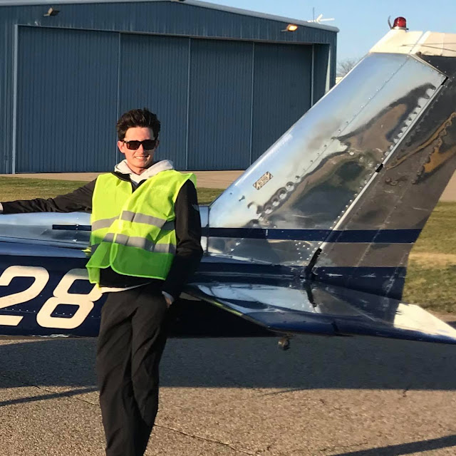
This is off subject but anyone know what model airplane Mr. Kennedy is standing in front of in that first pic ? The one with the chrome polished tail ?
ReplyDeleteThat is a slant tail Cessna 150, easy to identify by the vertical parting line of the fairing between Mr. Kennedy's shoulder and the vertical stabilizer, the tab protruding near the bottom of the rudder and details at the top portion of the tail.
DeleteLine drawing link:
https://cessna150152club.org/resources/Omni%20Slant.png
Line drawing is from:
https://cessna150152club.org/150-152-History
Browse tiktok videos associated with #polishedlife tag to see a full walk around of that aircraft. Takes a lot of dedicated effort to achieve a finish like that.
DeleteI thought it was a Cessna of some type. Thanks for the info about the C150.
Delete