
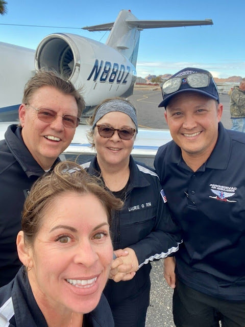
Learjet crash victims Tina Ward, Julian Bugaj, Laurie Gentz and Douglas Grande (clockwise from bottom).
Investigator In Charge (IIC): Cawthra, Joshua
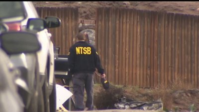
The National Transportation Safety Board traveled to the scene of this accident.
Additional Participating Entity:


Jonathan Burgess; Federal Aviation Administration / Flight Standards District Office; San Diego, California
Med Jet LLC
Location: El Cajon, California
Accident Number: WPR22FA068
Date and Time: December 27, 2021, 19:14 Local
Registration: N880Z
Aircraft: GATES LEARJET CORPORATION 35A
Injuries: 4 Fatal
Flight Conducted Under: Part 91: General aviation - Positioning
On December 27, 2021, about 1914 Pacific standard time, a Gates Learjet Corporation 35A, N880Z, was destroyed when it was involved in an accident near El Cajon, California. The 2 pilots, and 2 flight nurses were fatally injured. The airplane was operated as a Title 14 Code of Federal Regulations Part 91 repositioning flight.
Earlier in the day, the flight crew had flown from Lake Havasu City Airport (HII), Lake Havasu, Arizona, to John Wayne / Orange County Airport (SNA), Santa Ana, California, for a patient transfer. They departed SNA about 1856 to reposition to their home base at Gillespie Field (SEE), El Cajon, California.
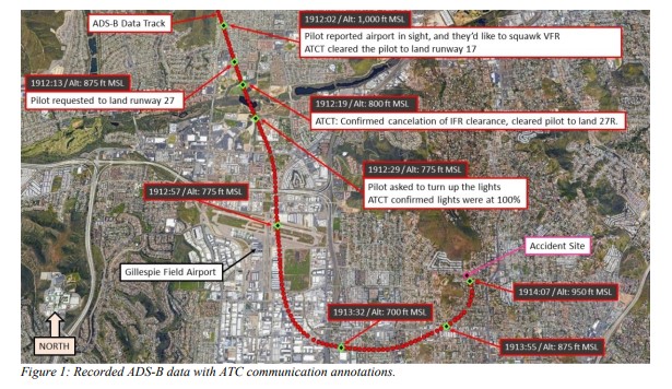
Review of preliminary communication recordings revealed that at 1908:23, the pilot contacted the SEE Air Traffic Control Tower (ATCT) and reported to the controller they were on the GPS approach to runway 17. The controller issued the current wind and cleared the pilot to land on runway 17. At 1912:03, the pilot reported the airport in sight and requested to squawk VFR. The controller did not acknowledge the request to squawk VFR, however, he reissued the landing clearance for runway 17.
At 1912:13, the pilot requested to land on runway 27. The controller asked the pilot if they wanted to cancel their IFR flight plan, to which the pilot replied, “yes sir.” The controller acknowledged that the IFR cancelation was received and instructed the pilot to overfly the field and enter left traffic for runway 27R and cleared them to land runway 27R. At 1912:30, the pilot requested that the runway lights for runway 27R be increased, however, the controller informed them that the lights were already at 100 percent.
Preliminary Automatic Dependent Surveillance-Broadcast (ADS-B) data showed that after departure from SNA, the flight made a left turn out over the waters of the Pacific Ocean and flew generally south – southeast along the coast and ascended to a cruise barometric altitude of about 11,000 ft sea level (MSL). After the flight passed Carlsbad, California, the airplane turned left and began to descend toward SEE. As shown in figure 1, ADS-B data showed that the airplane overflew SEE at a barometric altitude of about 775 ft MSL (407 ft above ground level) and entered a left downwind for runway 27R. While on the downwind leg, the airplane descended to a barometric altitude of 700 ft MSL, then ascended to a barometric altitude of 950 ft MSL while on the base leg. The last recorded ADS-B target was at 1914:09, at a barometric altitude of 875 ft MSL.
Examination of the accident site revealed that the airplane struck a set of power lines and subsequently impacted the yard of a residential home about 1.43 nautical miles east of the approach end of runway 27R. The airplane came to rest upright on a heading of about 118°, at an elevation of about 595 ft msl. The wreckage debris path was oriented on a heading of about 310° and was about 186 ft long and 90 ft wide. All major structural components of the airplane were located throughout the wreckage debris path. The wreckage was recovered to a secure location for further examination.
At 1855, recorded weather data at SEE showed weather conditions were variable wind at 5 knots, visibility of 3 statute miles, mist, broken cloud layer at 2,000 ft, overcast cloud layer at 2,600 ft, temperature of 10° C, dew point temperature of 8° C, and an altimeter setting of 29.98 inches of mercury. No precipitation was indicated.
At 1955, SEE reported a variable wind of 5 knots, visibility 3 statute miles, mist, broken cloud layer at 1,100 ft, overcast cloud layer at 2,600 ft, temperature of 10°C, dew point temperature of 8°C, and an altimeter setting of 29.96 inches of mercury. No precipitation was indicated.
Aircraft and Owner/Operator Information
Aircraft Make: GATES LEARJET CORPORATION
Registration: N880Z
Model/Series: 35A
Aircraft Category: Airplane
Amateur Built:
Operator:
Operating Certificate(s) Held: On-demand air taxi (135)
Operator Designator Code:
Meteorological Information and Flight Plan
Conditions at Accident Site: VMC
Condition of Light: Night
Observation Facility, Elevation: KSEE, 387 ft msl
Observation Time: 18:55 Local
Distance from Accident Site: 1.4 Nautical Miles
Temperature/Dew Point: 10°C /8°C
Lowest Cloud Condition:
Wind Speed/Gusts, Direction: / ,
Lowest Ceiling: Broken / 2000 ft AGL
Visibility: 3 miles
Altimeter Setting: 29.98 inches Hg
Type of Flight Plan Filed: IFR
Departure Point: Santa Ana, CA (SNA)
Destination: El Cajon, CA
Wreckage and Impact Information
Crew Injuries: 2 Fatal
Aircraft Damage: Destroyed
Passenger Injuries: 2 Fatal
Aircraft Fire: Unknown
Ground Injuries:
Aircraft Explosion: Unknown
Total Injuries: 4 Fatal
Latitude, Longitude: 32.821182,-116.93942 (est)
Those who may have information that might be relevant to the National Transportation Safety Board (NTSB) investigation may contact them by email witness@ntsb.gov, and any friends and family who want to contact investigators about the accident should email assistance@ntsb.gov. You can also call the NTSB Response Operations Center at 844-373-9922 or 202-314-6290.
Tina Ward, Flight Nurse
~


I live in San Diego and this was no night for circling approaches. He was lined up on the ILS for Runway 17, plenty long enough for his aircraft, then at the last minute, for reasons unknown, requested a circle to land Runway 27R, which is about 1,200 feet longer. Another circling approach in minimal conditions gone horribly wrong.
ReplyDelete7:14 PM PST = 19:14, +8 = 03:14Z UTC day 28.
DeleteMETARS:
KSEE 280355Z VRB05KT 3SM BR SCT011 BKN020 11/09 A2996
KSEE 280255Z VRB05KT 3SM BR BKN020 OVC026 10/08 A2998
KSEE 280213Z VRB06KT 5SM BR FEW019 BKN026 11/07 A2997
VASI was out of service for 17, per NOTAM:
Delete!SEE 11/001 SEE SVC PCL RWY 17 VASI U/S 2111021502-2201312359EST
There is no ILS at KSEE; all 3 approaches are non-precision. Circling at night on the RNAV-RWY 17 approach is NA, which is likely why he cancelled IFR, so he could legally change to RWY-27R.
DeleteMy question would be if he really wanted the runway length of 27R/9L, instead of doing RNAV 17 circle to 9, why didn't he just do RNAV RWY 9L and just land straight in to 9L? The winds were variable at 5knots so that wouldn't have been a factor on runway direction. The RNAV (GPS) RWY 9L has the lowest minimums out of any approach into KSEE and also is an LNAV/VNAV, so it provides vertical guidance unlike the RNAV RWY 17.
DeleteOk, as I'm writing this, I just answered my own question when I noticed that the RNAV RWY 9L is NA for category C and D aircraft. I'm guessing the Lear 35 is at least Category C.
So my modified question would be why didn't he choose to circle to land Runway 9 instead of 27, since circling to land Runway 9 off the RNAV 27 approach IS allowed at night unlike 27. Taking a look at the obstacles on the approach plate makes it obvious as to why.
Correction: "circling to land Runway 9 off the RNAV 17 approach IS allowed at night unlike 27"
DeleteThat's a very valid question to ask. This same jet landed at KSEE more than 10 times in the past three months and it was always on rwy 09/27. When approaching from the northwest similar to the accident flight for rwy 27, the approach was executed as a right traffic pattern. So clearly the pilots never intended to land on rwy 17. The question is had they reviewed their plan and studied all available options before canceling IFR and proceeding with rwy 27 visual approach?
DeleteI'm no Leer jet pilot but I don't see how the pilot could have overflown the field and still made the left turn to rwy 27 without first flying past south of I-8 for left base traffic pattern entry, not to mention that they were well below traffic pattern altitude for the aircraft category. Again it raises your question, why not land on rwy 09? Winds were variable at 5kt.
I agree. I saw the video after reading all the data and listening to the disturbing ATC recording. Without seeing the video of the crash it seemed like he didn't really have the field in site or it went out-of-site, per FA he was low and a bit slow, and I thought he probably rolled it going low and slow trying to horse the plane around where he absolutely shouldn't have been. The video (second part of the clip) where you see the lights almost cross each other confirms what the data and audio pointed to. Pilot error.
DeleteTracks:
ReplyDeletehttps://flightaware.com/live/flight/N880Z
https://globe.adsbexchange.com/?icao=ac2014&lat=32.822&lon=-116.971&zoom=13.2&showTrace=2021-12-28&trackLabels
Was the hill he was turning next to generating terrain warnings that influenced his piloting?
DeleteGoogle map, Pepper Drive near Bevin Lane.
https://www.google.com/maps/search/Pepper+Drive+near+Bevin+Lane,+el+cajon/@32.8230337,-116.9408632,14z/data=!5m1!1e4
Photo of hill:
https://goo.gl/maps/8chqtSLCb48nfNor9
The terrain rises rapidly just north of 27R. On a circle to land approach from 17, in last nights conditions, there would be no room for error. Just like the Truckee crash in July, too tight a turn and he stalled the aircraft. The video clearly shows the attempt at a turn to final for 27R while in and out of cloud and rain.
DeletePeople in the El Cajon/Santee crash zone might want to push back against circling approaches after adding this one to N7022G's crash.
DeleteHe wasn't doing a 'circling approach'. He cancelled IFR and was merely switching to land on RWY-27R VFR. Circling at night is NA for all 3 non-precision approaches at KSEE. And N7022G wasn't even going to KSEE; he was on the ILS RWY 28R (precision) approach to KMYF; a totally different approach that takes you straight-in to 28R at 250' minimums.
DeleteN880Z missed getting on VFR pattern altitude during the switch.
DeleteRwy 27R TPA 1588(1200) rgt tfc SR–SS, TPA 1388(1000) left tfc SS–SR due to 893 ́ AGL mountain 2.1 NM ENE of arpt.
The burn-injured folks in Santee that had their house destroyed and the UPS driver didn't care which airport an unqualified pilot failed his circular approach at.
"He wasn't doing a 'circling approach'."
DeleteIn effect, he was.
Exactly.
DeleteThe audio is on Live ATC and is pretty horrifying. Listener discretion highly advised.
ReplyDeleteAgreed. I only needed to hear that once.
DeleteIt's very disturbing.
DeleteThe classic "Oh shit! Oh shit!" and then screams. Always chilling, but why do these loss of control accidents continue to happen (and not just in Lear 35s)....
DeleteAnother Lear stall/spin resulting from an approach turn at low speed.
ReplyDeleteReminds of another 35A CA crash in 2017 at Teterboro.
DeleteHere is a great video from the NTSB about the Teterboro crash:
Deletehttps://www.youtube.com/watch?v=67Yw87l3Atw
Don’t forget the recent similar crash of the Challenger at Truckee
DeleteDon't forget in 2004, also in San Diego, another Learjet 35A, also an air ambulance, also decided to use a VFR procedure instead of an IFR procedure, only this was on departure and they ended up flying straight into a mountain not too long after takeoff.
DeleteIf you are referring to the Lear that hit Otay Mountain the SOCAL controller contributed to that one. Yes ultimately the PIC took most of the blame but the ATC could have prevented it, but didn’t.
DeleteYes, 100% agree. I read the interview with the SoCal controller in the accident docket. He basically said it wasn't his job to give VFR aircraft any warnings about terrain, so he never did, even though he used to be a controller at Brown and was well aware of the terrain risks. The controller also lied and said he didn't hear the low altitude alert for the flight because he was on the phone to Tijuana at the time, but time stamps showed the alert came in 30 seconds before he called TJ. Very sad.
DeleteAll correct. I was a controller at SOCAL when this occurred. I confronted this controller, who I knew well, about this and he always maintained he did nothing wrong. Although technically correct, was he morally correct? Not to stray too far off topic here, I am personally aware of two other incidents in San Diego airspace of a jet crash with loss of life that could have been prevented by timely controller action.
DeleteOn approach toward the holiday lights on Pepper Drive.
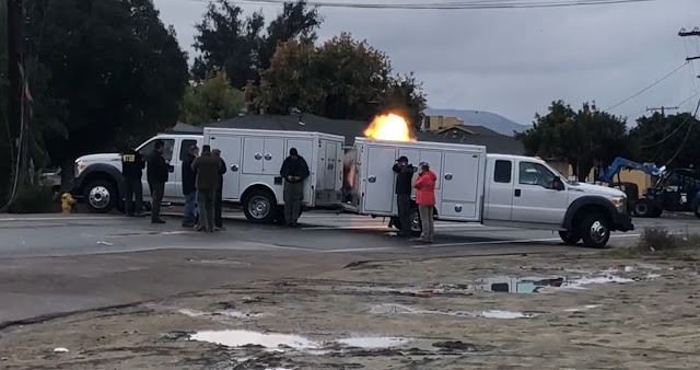
ReplyDeleteFuel on fire was creeping under a truck parked on the curb at the beginning of this video, looks like the owner got it started and moved to safety.
Deletehttps://twitter.com/i/status/1475863656692858889
Remarkable that no homes were hit.
Street view of crash location, matched to that video:
https://goo.gl/maps/FP7PkCFbmFohjRuP9
Linked below is a view looking down from Topper Lane onto the Pepper Drive/Bevin Lane intersection where the wreckage is seen in the news videos. You can get a good sense of the terrain proximity as he rounded his turn through there by comparing that image to a close-up look at the track:
DeleteView from Topper Lane:
https://goo.gl/maps/RoXyoFMY3rXxuJ7b6
Close-up of track with streets/names:
https://globe.adsbexchange.com/?icao=ac2014&lat=32.822&lon=-116.941&zoom=16.9&showTrace=2021-12-28&trackLabels×tamp=1640661250
The FAA needs to revisit circling minimums for faster airplanes. I have flown scores of RNP approaches with relatively tight RF (radius to fix) legs in garbage weather and can attest from firsthand experience that they are much safer and more predictable than "break out at minimums and good luck figuring out how to circle to another runway" circling maneuvers at the bottom of a ground based (or not) straight in to a different runway.
ReplyDeleteThe report shows four fatalities and it's a med evac Lear 35, so I'm assuming two pilots and either two medical personal or one medical person plus one patient. Such a tragic loss of life. And as others have mentioned, the audio is heart rending to listen to.
And for the pilots who are doing these approaches in foul weather - remember that "UNABLE" or "GOING AROUND" or "DIVERTING TO OUR ALTERNATE" are all acceptable answers and will absolutely yield a better outcome than a steep, tight turn at low altitude in garbage weather that leads to an irrecoverable stall.
ReplyDeleteTrue, but in this case, the pilot requested the circle
DeleteIs it me or am I not reading the RNAV rwy 17 approach plate into KSEE (Gillepsie Fld) correctly?
Delete- Circling NA (not authorized) northeast of Rwys 17 and 27R.
- Circling Rwy 27R, 35 NA at night
It makes me wonder if the approach was fully briefed and what was the contingency plan if he didn't feel comfortable landing on the shorter Rwy 17 in inclement weather with it's VASI lights out of service as mentioned above.
Circling minimum is 1400' MSL but ADSB shows plane as low as 700-800' MSL over the field.
DeleteHe was making his turn with 893' AGL Rattlesnake mountain providing a solid backstop if turn went too wide. Crashed at it's base.
DeleteAIRPORT REMARKS:
Rwy 27R centerline in close alignment with terrain, use of Localizer/DME highly recommended.
Rwy 27R TPA 1588(1200) rgt tfc SR–SS, TPA 1388(1000) left tfc SS–SR due to 893 ́ AGL mountain 2.1 NM ENE of arpt.
https://aeronav.faa.gov/afd/02dec2021/sw_218_02DEC2021.pdf
https://eccalifornian.com/exploring-the-breathtaking-beauty-of-rattlesnake-mountain-habitat-preserve/
He wasn't "circling" --- THAT'S why he cancelled IFR; so he could switch to 27R (VFR; not IFR, which he cancelled). A small, technical, but essential point, which a lot of people are missing. He cancelled IFR, because Circling (IFR) at Night is NA for all 3 non-precision approaches at KSEE.
DeleteHe missed getting to VFR pattern altitude during the switch.
DeleteRwy 27R TPA 1588(1200) rgt tfc SR–SS, TPA 1388(1000) left tfc SS–SR due to 893 ́ AGL mountain 2.1 NM ENE of arpt.
He may have been flying so low to maintain the legally required 500 foot clearance below the scattered layer at 1,100 AGL as reported on the METAR. Which begs the question of why he cancelled IFR which would require him to maintain VFR cloud clearance, instead of requesting a visual or contact approach while staying IFR, which would have allowed him to simply remain clear of clouds while conducting whatever approach he wanted.
DeletePilot was based at Gillespie Field and may have been over-confident. His request to have the runway lights turned up and complete surprise at the stall suggests some degree of spatial disorientation or lack of situational awareness. There may be more to the story, but at first glance this appears to be an avoidable tragedy.
DeletePretty sure this Lear went by my house in Carlsbad at about 250 kts. and 3000 feet, VFR? Way too fast. Don't hurry a Lear, steep turn, they can bite.
ReplyDeleteI'm in Rancho Bernardo and they normally cross overhead at 5 or 6 thousand on the RNAV to 17. 3,000 over Carlsbad? No way!
DeleteCrossed over KCRQ at 8,200' and Rancho Bernardo at 4,200'.
DeleteMaybe not the Lear then, but whomever it was, their speed was more than twice what normal jets hold in the area going into Palomar Airport. Awfully weird coincidence even with the time. Did this 35 have thrust reversers (they are optional)? is this why he wanted longer runway?
DeleteSeems like power lines pretty high in that area and if he was dipping lower to find runway. Should of landed 17 plenty of distance.
ReplyDeleteThis photo shows the power lines he hit, 1.6 miles from RW27 threshold, while next to 893' AGL Rattlesnake mountain, which is off the the right when you spin the view:
Deletehttps://goo.gl/maps/FP7PkCFbmFohjRuP9
^^ Correcting: off to the left when you spin the view..
DeleteThe hill to the right is where Topper drive goes up.
The power lines aren't that high. His last two ADS-B returns were (corrected) 1050' AGL and then 925' AGL. The obstacle database shows an unlit tower (probably that power pole) at 641' MSL (55' AGL) in the area of the crash site. He crashed because he stalled when overbanking to try to avoid hitting Rattlesnake mountain and hit the power lines on the way down, he didn't crash because he hit the power lines.
DeleteCorrection, his last two ADS-B returns were (corrected) 1050' MSL and then 925' MSL. The ground speed of those last two points was 101 kts and 85 kts respectively. The flaps down stall speed of a Learjet 35A is 96 kts, and that is level. 1G stall speed increases with bank angle.
DeleteRunway 17 is not long enough especially with a wet surface.
DeleteRW17 is plenty long even when wet for a LJ35 with its powerful brakes and Dee Howard reversers. I know reversers are not figured in landing distance but non the less they are there. A much better gray area choice than canceling IFR to perform an unauthorized circle in poor weather. Considering the weather, the prudent choice would have been to RON in SNA. If the choice was made to get home no matter what, the best choice was straight in RW17.
DeleteHe may have not been making an "official" circle to land approach but the only way to switch from 17 to 27R is by CIRCLING. He wasn't being vectored to another runway, he had to CIRCLE to it.
ReplyDeleteExactly!
DeleteOMG guys…CIRCLE IS AN IFR maneuver!!! He cancelled IFR and you can’t CIRCLE AT NIGHT. He simply was WAY TO LOW and stalled it base to final. He cut the corner way to tight
DeleteRelax. The path taken was a circle. Sure, he cancelled IFR, then turned in a circle. Airplanes don't refuse to respond to left turn control input just because it is night time.
DeleteYes, Anonymous Commenter at 6:28 EST, we all know circling is an IFR maneuver, but a wise pilot, especially one that is IFR trained, should take a very close look at the published restrictions to IFR procedures and use that as a guide to what might not be advisable to perform visually as a VFR maneuver. ESPECIALLY if you are choosing to go VFR at night in very marginal VFR conditions like at the time of the accident. If an airport has an approach that makes circling NA at night to a certain runway, I would never do a visual approach to that runway that wasn't a straight in approach unless I knew the surrounding terrain extremely well.
DeleteThere's good reasons why "circling" is prohibited at airports, for various reasons (terrain features, lower weather minimum visibility, etc.) - to get around the "circling at night" prohibition here, the pilot simply cancelled IFR, obviating the prohibition. Safe? Apparently not safe enough in this instance. Sad.
DeleteLegal technicalities KILL pilots. Watch Accident case study: faulty assumptions. Legal doesn't mean prudent or good judgement.
DeleteTo those saying circling is an IFR maneuver... no, it really isn't.
DeleteIt is part of an IFR approach, but the circling must always be done visually.
He cancelled his IFR because he couldn't legally circle at night, so he did it VFR is very marginal conditions while flying way too low. Probably a very experienced pilot as a newer pilot would never try something that dangerous.
Still not sure if he stalled it or just got caught flying into rising terrain.
He was way below minimums on the approach and crossed the airport at 300' AGL!
Stalled it after realizing terrain was there & reacting.
DeleteMay have realized that the reason he suddenly couldn't see ground lighting of the streets and buildings anymore was because the rock he knew existed from previous experience was now out front, dark and unseen while he turned in front of it at low AGL.
A few choice words during advancing throttles while pulling up and banking harder trying to complete the turn to final inside the intended arc but the accelerated stall took hold and that was it.
I think the recommendation above is good advise. It is best to remove the use of the word circle as it can only be used in a IFR context. This pilot cancelled his IFR and in that instance he was flying VFR and entering a Left Downwind for 27. He was required to maintain 3 Miles vis 1000 and 500. The video on the Ring Camera shows him coming out of the overcast in a almost 90 degree angle down, most likely after a Stall Spin in IMC.
DeleteSmells like the crash in Truckee not long ago where a circling approach went terribly bad. Or the Learjet 35 in Teterboro although that one was sheer incompetence.
ReplyDeleteAlways that tight turn stalling fast jets and no altitude to recover...
The fact that ANY circling to the NE, and night circling to 27R/35 is NA (prohibited) as part of any IAP tells you everything you need to know. Anything short of very good weather, a high degree of local familiarity, AND a perfectly-executed traffic pattern is a recipe for disaster. RIP.
DeleteLooking at execution of the previous N880Z landing to 27R @ 0100Z UTC day 24 finds an unusual track. Pilot with similar voice as accident pilot communicates VFR intent at 28:30 elapsed time on that day's LiveAtc recording.
DeleteTrack:
https://globe.adsbexchange.com/?icao=ac2014&lat=32.827&lon=-116.948&zoom=12.2&showTrace=2021-12-24&leg=1&trackLabels
https://flightaware.com/live/flight/N880Z/history/20211223/2120Z/KLBB/KSEE
That approach's METAR:
KSEE 240049Z 00000KT 10SM OVC050 13/08 A2998,M
That approach's LiveAtc:
https://archive.liveatc.net/ksee/KSEE-Dec-24-2021-0030Z.mp3
Compare to a recent Falcon 2000 21:16Z arrival to 28R:
https://globe.adsbexchange.com/?icao=ac2547&lat=32.829&lon=-116.951&zoom=12.5&showTrace=2021-12-28&trackLabels
Falcon arrival METARS:
KSEE 282147Z 23005KT 10SM FEW022 SCT033 BKN046 12/06 A2987
KSEE 282047Z 22009KT 10SM FEW027 SCT044 BKN049 13/07 A2988
So why do pilots who know better do this kind of mistake? In truckee-tahoe and here the pilots could have continued a perfectly stable approach to a landing on a runway with enough length to accomodate yet decided to screw up a perfectly good thing.
DeleteAfter CFIT should we invent the new acronym CDSA i.e Controlled Deviation from Stabilized Approach? i.e having a perfectly stabilized approach and all configured and giving in to a weird itch to mess up a good thing?
I would tweak it to UDSA: Unexplained Deviation from Stabilized Approach. These crashes will leave us wondering why indefinitely...
DeleteMake a plan and stay with it until/unless deciding to go missed, then adhere to the missed, then make a new plan, same as big metal does.
DeleteBased on the METAR(s) and ground track(s), I would assume that N880Z was VFR, below the 5000' overcast layer. The Falcon looks to be on the LOC-D approach to 27R, though I have not listened to that ATC audio.
DeleteFWIW, charter operators often define runway minimums for landing and it's common for Lear operators to require a 5000' runway, which would explain the switch to 27R.
What I could not explain is why the pilot asked for VFR and then descended so far below VFR pattern altitude before over-flying the field.
I think it was because he probably still couldn't see the runway even tho he was supposed to be "VFR" hence asking for the lights to be turned up when they were already at 100pct.
DeleteHere are some sobering facts:
ReplyDeleteLear 35A circle to land in Palwakee, IL results in a crash
Lear 35A circle to land in Truckee, CA results in a crash.
Lear 35A circle to land in Teterboro, NJ results in a crash
Lear 35A circle El Cajon, Ca probable factor in the crash.
I flew the Lear 23, 24B, 25, 35A, 36, 40, 45 & 55. I fly 747’s now. Lear 35A recurrent was always interesting because the aircraft had 7 different wings: Century III, Softflight, Mark 7, etc…..While it is important to respect all aircraft limitations, it especially holds true with the OLDER Lear jets. In particular, the 20 degree bank limitation with full flaps & at low speed.
The NTSB database is full of highly experienced DECEASED Learjet pilots. When people ask me what it was like to fly a Learjet, my response is always the same. Imagine a fireplace with the fireplace being the aircrafts limitations. Now imagine a huge fire inside that fireplace. Not much margin for error. For most aircraft, the fire is much smaller; allowing for greater margins of safety all around. 😢
Do normal flight operations in a Lear really require getting close to the margins of the flight envelope? If a pilot flew a Learjet with the mindset of flying an airliner, could a Learjet be as safe as an airliner? As a low-time private pilot, this accident looks to me like a pilot trying to fly a passenger jet like a Piper. Is the problem that employers wouldn't accept small business jets being flown like 737s, diverting to KSAN on a night like that?
DeleteHere are some sobering facts:
ReplyDeleteLear 35A circle to land in Palwakee, IL results in a crash
Lear 35A circle to land in Truckee, CA results in a crash.
Lear 35A circle to land in Teterboro, NJ results in a crash
Lear 35A circle El Cajon, Ca probable factor in the crash.
I flew the Lear 23, 24B, 25, 35A, 36, 40, 45 & 55. I fly 747’s now. Lear 35A recurrent was always interesting because the aircraft had 7 different wings: Century III, Softflight, Mark 7, etc…..While it is important to respect all aircraft limitations, it especially holds true with the OLDER Lear jets. In particular, the 20 degree bank limitation with full flaps & at low speed.
The NTSB database is full of highly experienced DECEASED Learjet pilots. When people ask me what it was like to fly a Learjet, my response is always the same. Imagine a fireplace with the fireplace being the aircrafts limitations. Now imagine a huge fire inside that fireplace. Not much margin for error. For most aircraft, the fire is much smaller; allowing for greater margins of safety all around. 😢
If you watch and listen you can clearly hear the engines spool up as if the airspeed was low then just before the trees you can see the jet change trajectory. Clean case of cutting in way to tight, low altitude, being way to low. Stall spin base to final.
ReplyDeleteOnly to save himself time on taxi….. this is the reason why i think he changed to runway 28R. Runway 17 would have had him on the other side of the airport and would have had to taxi all the way back. NEVER a good idea to cancel IFR…. RIP
This plane landed on rwy 09/27 at KSEE at least 10 times in the past three months. The pilots never intended to land on a "new" runway in marginal weather. As mentioned above, they question is why didn't they land on rwy 09 instead which is a much simpler maneuver compared to making a left 260 to land on rwy 27?
DeleteActually, the aircraft was based on the East side of the field adjacent to 17/35. It wasn't about shortening the taxi.
Deletewas that an open mic from the right seat?
ReplyDeletehttps://jetadvisors.com/learjet-35a-performance/
ReplyDeleteEven under wet conditions a 4k runway would have been adequate... so he had no reason to deviate from the ILS approach to 17.
It was a GPS RWY 17 not an ILS and the landing distance available was 3695ft (displaced threshold). Without running the numbers, I'm thinking you might now have wet numbers for that length of runway.
DeleteThe problems started when he went below the published TPA of 1388 MSL for left traffic to 27R when he was still 3 NM out from overflying the airport to enter left traffic. He then went down to as low as 750 MSL as he overflew the airport, that's 600 below TPA and a less than 400 feet above the airport. The problems continued when he flew a non-standard traffic pattern, overflying the field too far east, cutting his downwind and base in way too close while still far too low and basically ended up pointing himself at a hill with an elevation of 1,200 MSL when he was only at 900 MSL.
ReplyDeleteHis comment to ATC about turning the lights up when they already were at 100% shows that he was probably looking left struggling to see the field and then looked ahead and realized he had gotten too low and too far north east and was heading straight for Rattlesnake mountain at 1200 MSL, likely eliciting the profanity as he tried to bank and climb to avoid hitting the hill and ended up in an accelerated stall.
(Note: Altimeter was 29.97, so add 50 feet to the ADS-B reported barometric pressure altitude to get indicated altitude. Or if you are looking at the ADS-B geometric altitude, the geoid height at KSEE is around 100 feet, so add that to the geometric altitude to get true AGL altitude.)
Exactly!
DeleteI have been based at KSEE since 1985. We had just landed at KSAN and were on a shuttle to get our car when we received the alert on our cell. Did a quick check of weather and El Cajon was reporting fog. Not uncommon during rain because KSEE is in a valley and the spread between temp and dew point nears zero.
ReplyDeleteOn my first solo flight into KSEE as a student I was quite intimidated turning a left base for 27L by the looming Rattlesnake Mountain directly in front of me. And I was landing in daylight. From the FlightAware track the Lear appears to have started his easterly turn very early and only 300 feet AGL. Tracking North at 160 mpg the mountain dead ahead would surely get your attention. Very likely there was not enough room to finish the turn to final without an extremely sharp left turn. With the small crash footprint it clearly came down at a steep angle. Sure sounds like a stall/spin.
BTW - right traffic to 27R is daytime only. Just before turning base you lose sight of the field behind the mountain so left traffic at night.
The video posted where, in the second part, you see the wing lights just about flip over would validate what you're saying. He was trying to horse the plane around too low and too slow and flew it into the ground. Not to mention he was asking ATC to turn up the runway lights and they told him they've been at 100% means he probably didn't have the runway in sight or, if he did, they were obscured at least momentarily meaning, well, my god, if you're flying IFR hard banking towards a filed you don't have in sight that low... I mean, the result was almost inevitable.
DeleteSame here too... 27R is intimidating and I was flying daytime VFR and got a slew of alerts from the tower about terrain as I would turn base to final. The final is so close to the mountain is almost eerie.
DeleteIt is similar to KRIR i.e Flabob with a huge hill right next to Final.
Chill with the IFR circle talk. He made a circle to land PERIOD. Irrelevant if he cancelled or not. Cancelling shows he had it planned as they cancelled then continued the "marginal vfr/IFR condition" circle. They probably discussed this before the approach even began. Low and slow. The winds were not variable according to the tower. It appears to me continuing that approach was suicide. They pitched up before attempting to accelerate and that is probably what doomed them. It is sad that people do not respect limitations and this has to happen. Although very doubtful, maybe there is something we don't know yet that would contribute to this decision. No antiskid for example? Other pressure from the higher ups? Regardless, it was a very poor decision and they payed the ultimate price.
ReplyDeleteI would assume most on here know a "circle" is an IFR term. Worry less about the small things and worry more about what matters. Keep that speed up and have an out.
190@5 were the winds.
ReplyDeleteFairly negligible winds for an aircraft with the landing speed of a Learjet. In any case, those winds would say to land runway 17, it'll be mostly a crosswind for either 9 or 27, very slight (<1 knot) headwind for 27 and same (<1 knot) tailwind for 9. With winds clearly no factor, runway 9 would have been a much safer choice over 27 given the terrain.
DeleteNo matter what...he was not "circling" as part of the approach he was cleared for. He was simply changing the runway AFTER he cancelled IFR. You can hear the controller on the recording state: "CHANGE RUNWAY" and then the landing clearance. The only controller who can assign a "circling" maneuver is the approach controller who originally authorized the approach. You may peruse the Air Traffic Control handbook: FAA 7110.65, Chapter 4, Paragraph 8, Sub Paragraph 6 for the "Approach Clearance Procedure" for a circling approach. The tower controller used the Change Runway phraseology from Chapter 3, Paragraph 10, Sub Paragraph 5, "Landing Clearance." In the note for the paragraph, it states: NOTE−
ReplyDeleteThe purpose of the “change to runway” phraseology and
restating the runway number is to emphasize to the pilot
that they are being cleared to land on a runway other than
what they were expecting."
So: the controller made sure the aircraft cancelled his IFR clearance. The aircraft was now just a VFR aircraft in the pattern. "Change Runway" was used to clear the aircraft to land on a runway they were not expecting (due to pilot request.) The tower controller (maybe) co-ordinated with the approach controller to point out the aircraft has cancelled IFR and is changing to a different landing runway.
So: a VFR aircraft crashed turning base to a runway.
Your attempt at being pedantic is missing the point. Other that the flight rules, what is the difference between an IFR circle to land and what this pilot did? Weather? At 3 SM, vis was RIGHT at the limit for legal VFR. Pattern? The pattern this pilot flew looked like a typical tight IFR circle to land track trying to stay within a 2.3 NM radius rather than the larger standard rectangular VFR traffic pattern that a light jet would typically do in VFR conditions. I'm sure you can guess why.
DeleteSo: an IFR aircraft cancelled IFR in order to perform a maneuver that would otherwise been illegal at night due to terrain and then crashed due to terrain.
The real question you should ask is why didn't this pilot request a visual or contact approach if they wanted 27, instead of canceling IFR. The weather technically would have allowed either.
Or better yet, why didn't the pilot request to circle to land runway 9, which is longer AND allows circling at night.
Paul, you are absolutely determined not to learn anything from this accident. Open your eyes.
DeleteHe was making what would have been about a 260 left turn and if you look at the track he was tightening the turn to align with the runway. Too much bank and too slow.
DeleteHe made a circling maneuver while vfr in marginal vmc/imc conditions and stalled base to final.
ReplyDeleteWhat's your point?
The pilot cancelled when he told the controller he would sqwack 1200 he cancelled IFR. The controller verified his cancelation as he can't authorize a circle. The controller could not stop him from cancelling. The pilot decided to circle. Call it what you will. He attempted a circling manuver to change runways.
Are you just wanted to get the point across that he was a VFR aircraft when he crashed because you want to argue?
Staying IFR would have saved him in this situation as a circle is not authorized, but it wouldn't have saved the 35 in TEB. IFR fp or VFR what difference does it make. He got slow "circling" back or turning it around beyond a 180° to change runways.
I don't think he could have circled with 9 approach as his CAT is not authorized unless I missed something.
ReplyDeleteHe should have gone to an alternate. I can't believe this still happens. Complacency? People like the above poster worrying about ATC books vs flying the damn aircraft and having good ADM?
Accidents are suppose to help us learn for the future. We've had enough of these types of accidents.
Circling to RWY 9 on the RNAV (GPS) RWY 17 approach is allowed for categories A through D. It is the RNAV (GPS) RWY 9L approach that is not allowed for categories higher than B. But yes, an alternate would have been the best choice. Montgomery has a nice ILS and RNAV that goes down to 250 ft minimums and of course KSAN has even better.
DeleteSo here we learned that a switch to VFR basically allows the pilots to become VFR cowboys and do whatever they please since the METAR was still VFR although marginal, as IFR would constrain them to finalize the landing on 17. They wanted 1000 ft of runway more vs runway 17 which has 4000 ft for a landing performance of 2500 ft for the 35A. Even assuming wet conditions 17 was the right choice. I didn't realize this was a loophole of sorts to force a circling approach when such an approach is prohibited like here at night.
ReplyDeleteGood take...it must have been the long taxi they wanted to avoid...at what cost!
DeleteA lack of physics understanding is at the root of these accidents.
ReplyDeleteThe most significant benefit of a stable straight-in approach is that there are a minimal number of variables simultaneously requiring management.
It isn't even necessary to list the competing variables in the physics of (have to say this carefully to not trigger the circle arguing) guiding the aircraft along a curving path and getting aligned, on slope and managing energy while doing so. And all by "the seat of the pants", Red Bull style.
Choosing to test your abilities at night in poor weather on a (careful now) curving path at an altitude that puts you below known terrain located in that turn as a solid CFIT backstop (that fills up your windshield if managing ALL of the competing effects of physics isn't done just right) is madness.
A stabilized approach to 17 was the only safe way to go in the conditions that existed. Sure, a smaller aircraft, say a Cessna 210, could have made the turn to 27, but a Lear? Co-pilot should have been monitoring the AS, speeds recorded below 100 and steeply banked? whose kidding who, pilot forgot the basics, tired, too casual in the approach, getting home syndrome after a long day. It's all there.
DeleteThe article states they crashed 1.4 miles from the runway and I think was reported as 3 miles on ATIS, correct me if I'm wrong.
ReplyDeleteCould have been a repeat of the Teterboro crash where the inexperienced first officer was flying. We'll have to wait and see.
Crashed during the turn, at Pepper Drive/Bevin Lane intersection.
DeleteHere is a view looking down on the intersection from Topper Lane:
https://goo.gl/maps/RoXyoFMY3rXxuJ7b6
Would climbing straight have been a better option than trying to make a tight turn?
ReplyDeleteWould the assumption be PIC or FO was hand flying? I know if it were me in that kind of weather and at night I'd have the AP on...set to altitude hold and using the heading bug for base/final. Also, there is a localizer for 27 and you'd think as the needle becomes live you'd center that up and prep for final...
ReplyDeleteIf that weren't enough then if you fly into KSEE often perhaps they should have had some user defined waypoints to help guide you to IAP/FAF/RWY.
I agree with your point about dialing in the localizer for better situational awareness.
DeleteBut yikes, I definitely would not be using the autopilot to fly a visual 270 turn to final. Autopilots generally only turn at one rate, so you are basically praying you dial in exactly the right headings in at precisely the right time or you are going to hit the mountain or under/overshoot final. Visual night flight in MVMC is not the time to be looking inside the cockpit at the heading bug while you fiddle with the autopilot knobs when you should be looking outside for the runway and terrain. If the autopilot doesn't turn exactly as you want it, does something different, or just lags a bit, you are going to need to instantly disconnect the autopilot and hand fly, which can be quite dangerous and disorienting to adapt to if you haven't been hand flying it for the past few hours in cruise. Not something you want to do at 400 AGL with a mountain looming.
It reminds me of Vanderburgh's Magenta Line video when he talks about a training crew getting a traffic warning and going heads down to fiddle with the autopilot to avoid the other aircraft when they really needed to just disconnect and hand fly to avoid the imminent collision.
a case of a long day, a final 15 minute flight back to their homebase on muscle memory, apparently making ill-conceived decisions of expediency attempting to defy gravity. RIP.
ReplyDeleteOn 11/4/2021 I flew my RV-10 IFR from the Sacramento area to KSEE at 13K, cleared via the coast route to Mission Bay VOR and then vectors east to Gillespie. ATC asks for preferred approach and I ask for the visual, if available. Over Oceanside VOR SoCal calls and says "Amendment to your routing, turn left to 100, vectors for inbound traffic which is a Medevac Learjet." Approaching the field from the northwest in Miramar's airspace, and only about 7 miles north of the field, ATC says "Do you have the field in sight?" Me: "Oh there it is, field in sight." (Coastal stratus has given way to severe clear in the east county). SoCal: "Tower now on 120.7" I check in with the Tower with the current ATIS. Tower: "Make right traffic for RWY 27R, you are number two following a Learjet on a 4 mile straight in." Me: "Tower, first time here. There seems to be a mountain next to RWY 27R. Do I fly around the mountain or turn inside of it for the runway?" Tower: "Normal pattern goes around the mountain."
ReplyDeleteMe: "Roger that." Never saw the Learjet but the runway did reappear base turning final, in a "vigorous" descent from 4000 feet. Very exciting and a successful landing, but very glad to have done that in CAVU conditions since I was expecting vectors out over the tall granite to the east for the approach to 27R. Now I think I know who I was following...
I wouldn't fly a 172 day VFR in 3NM/-BR, let alone a Lear VFR 400' AGL at night in that murk.
ReplyDeletePart 131 operators should be thinking seriously about allowing their crews to perform circle to land approaches. The recent rash of accidents while performing CTL approaches makes it clear that training is lacking. Once again, the flying public has no idea the risk they are taking. In this case the 2 nurses on board put their trust in this crew to operate safely.
ReplyDeleteAnd training needs to be in the target aircraft, done for real at the airfield, not on a desktop simulation to just check the box.
DeleteRecurring demonstration, not just once. Problem then will be training crashes, similar to auto-rotation hard landings, but the truth of ability will become known.
I'm an aeronerd, not a pilot, so I hope this isn't too dumb... It would have taken a fair bit longer, but what about going out to BARET and doing a stabilized localizer approach? Get all nice and configured way out, then drive straight on in to 27R. Rattlesnake is attention getting even in daylight/clear, can't imagine on a dark and stormy night with an unforgiving platform like L35s seem to be.
ReplyDeleteThanks.
A rational hindsight, as other could-have should-have would-have mentioned comments, yet it appears get-home-itis to home base after a long day was of importance to PICs last second decision making. RIP.
DeleteSame as they had done on Sunday....
Deletehttps://flightaware.com/live/flight/N880Z/history/20211226/2100Z/KBUR/KSEE
Not dumb at all, that's a good thought, but to see why it wouldn't work takes a little digging. So BARET is the IAF for the LOC-D approach into KSEE. The approaches to all runways on the LOC-D approach are circling approaches per the minimum table. This can seem counterintuitive because the approach appears to take you straight in to runway 27R. The reason why it's not straight in to 27R is because it requires a 745 FT/NM descent rate to land from DEBEY at 2700, which exceeds the 400 FT/NM straight in limit. Diving at the threshold of 27R at 745 ft/nm from DEBEY would be at least a 1700 FPM descent at a Learjet's approach speeds and result in a dangerous unstablized approach. So to land on 27R on the LOC-D approach would require a circling maneuver and, like all the approaches into KSEE, circling to 27R is not authorized at night.
DeleteI feel compelled to point out the poor ADM of cancelling IFR on an approach when you have 3 miles visibility, a broken layer at 2000 AGL and overcast layer at 2600 AGL (and possibly a scattered layer at 1100 AGL per the later METAR). Once you cancel IFR, you are not authorized to fly the missed approach procedure and must maintain VFR cloud clearances at all times, so if they ended up having to go around for any reason, they would now be basically scud running to stay 500 feet below the cloud layers, while also dodging numerous mountains with peaks above them in 3SM visibility while going 160+ knots. They would have to keep doing this until they were able to contact SoCal on the correct frequency, get a squawk code, get radar identified, and receive a pop-up IFR clearance to be able to climb through the clouds (possibly without vectors and no guaranteed terrain clearance if they were below MVA). Sure, they could declare an emergency and just climb, but the FAA would take a dim view of your chosen go around procedure requiring you to declare an emergency.
ReplyDeleteI want to point this out because some pilots don't consider the ramifications of what they would do if they have to go around when they cancel IFR in MVFR conditions. You are basically putting unnecessary pressure on yourself to complete the approach no matter what, because your plan B suddenly became a whole lot more dangerous the moment you cancelled IFR.
"How to cancel an IFR flight plan in the air: First, this is so important: pilots cannot cancel their IFR clearance unless they can maintain VFR cloud clearance.
DeleteSo, when the field is IFR (1000′ and 3) do not cancel in the air. I would argue if the clouds are less than 3000′ and visibility is less than 5 miles, don’t cancel in the air either!
... also that final approach fixes are typically built 5 miles out. If you can barely pick out an airport within 5 miles, your chances of a stable, safe approach diminish substantially. It gets real ugly real quick when you’re trying to locate the airport, cancel your IFR flight plan, set up for the approach, and stay clear of other traffic!" January 13, 2021 By Sarah Fritts https://www.thinkaviation.net/how-to-cancel-a-flight-plan/
Yes Mr. Anonymous: Right on the money. The PIC pretty much sealed their fate when cancelled IFR for a very questionable alternative. Why, oh why?
DeleteHere's my take on it as a current and proficient instrument pilot: Part 121 ops don't fly circling approaches, therefore I don't fly circling approaches. It's just that simple.
ReplyDeleteQuestion for any L35 drivers -- is 4100 feet adequate for wet runway ops?
ReplyDelete8000 hrs LR24-55 mostly LR35 my personal wet minimums were 5000 feet.
DeleteHad a constant running argument with owner of a 35 but that is what I stuck to
The problem with VFR at night in marginal weather.....is that you still need to maintain sight of the airport. Compound the factors of a fast high performance jet....transitioning from an IFR straight in procedure to VFR.....at night....in bad conditions....with terrain as a factor. DFIU. Seems like a classic approach turn stall maybe compounded by an overshooting approach turn and terrain.
ReplyDeleteIf they cancelled and felt it was an emergency they can do whatever they want and enter back into IMC which would have been a better idea than what happened. Not trying to be an arm chair quarterback,, but if you take a cowboy manuver you need to reap the consequences of your actions. If it is a split decision of oh this was a bad idea and turn to a safe heading and climb into imc so be it. Have fun explaining that one, but you could possibly live to tell wtf you were doing, take a hit on the wrist and get on with it. Fly the aircraft, navigate and then communicate.
ReplyDeleteSo this is why there are pattern altitudes ....circling and approach mins. If you cancel and go VFR...you should be able to maintain pattern altitude. That means altitude AND distance. You stick to the altitudes and distances and if you go accidentally go IMC.....there is a procedure for that.
DeleteHe cancelled IFR and went on the visual to 27r so he has more runway which is required for a Learjet at 4333 landing distance required . He experienced spatial disorientation.
ReplyDeleteRunway 17 plenty good if you have thrust reversers. Lots of Lears go in and out of 4000' every day. If you can't stop, better to overrun at 30 than crash in a stall/spin dive into the ground at 150+.
DeleteWhy they would switch from IFR to VFR when it was fog conditions? Instruments not working properly? That is one of the fears from the FAA with certain cities going 5G around the airports. It sounds to me like it is pilots error(s) and they were not where they thought they were positioned.
ReplyDeleteVFR conditions are not "fog". You cancel IFR because it was illegal to do an IFR circle to land maneuver to the Rwy they wanted. But you have to maintain VFR...aka knot fly into the clouds and have enough visibility.
DeleteI wouldn't be so cavalier about declaring an emergency to fly into clouds. There is a very good reason its illegal to get too close to clouds if you aren't on an IFR flight plan: other IFR traffic. You cancel IFR, need to go around, and declare an emergency to roll your own special missed approach procedure into the clouds, you are now risking the lives of other IFR pilots and passengers through your bad decisions. Don't make your emergency their emergency. The crew and passengers of that airliner on final to KSAN that you could hit didn't have a say in your decision to play VFR cowboy in near IMC.
ReplyDeleteBingo
DeleteOf course it isn't a good idea. Obviously this whole situation was not a good idea. It is an option though. Unfortunately this is like politics. You have some cowboys and you have some guys speaking about ATC handbooks and we "can't call it a circling approach" lol.
ReplyDeleteIf it was planned properly a missed approach most likely could have been executed with 0 issues. 0 issues besides a pretty serious report.
Unfortunately it doesn't appear there was an escape route planned.
I executed a missed approach... OMG let me rephrase this... I made a go around after cancelling IFR in an airport that was left pattern only. I had reason to make right pattern so guess what? I made right pattern.
If your unable to plan an escape route in a situation we're atc might not be available to help you that very second and your off flight plan you may want to reconsider what your doing all together.
I am not condoning a go around in IMC, but if needed you would be a fool not too.
The guy wasn't in a right pattern for 27R. He crossed over Rwy 27R into a short modified LEFT downwind south/southeast of the field, and then transitioned into a modified turning LEFT base to final. This is where the issue arose. Too close, too low, too slow, and too steep of a bank angle.
DeleteSEE HERE:
https://globe.adsbexchange.com/?icao=ac2014&lat=32.826&lon=-116.972&zoom=14.2&showTrace=2021-12-28
Now that we are all pretty sure of what happened i.e cavalier IFR cancelation to do a rogue VFR circling in MVFR bordering on IFR and basic accelerated stall, I am pretty sure the NTSB will dig deep and uncover interesting patterns of deviance and carelessness like what happened in Teterboro or the lack of basic checklist application and gust locks left hindering the controls for the jet in Bedford, MA that killed Lewis Katz. Like always it's not the one single occurence of deviance that kills you but a repeated pattern of taking chances and shortcuts until that one time too many...
ReplyDeleteWith the 17-approach aborted with an over the field flyover one thing that I noticed, and think was a big factor was the tight left turn especially in a fast jet at night and in marginal weather. I'm sure the Garman was giving them position indication relative to the airport. Only the pilot flying knows for sure what he was thinking on what the plan was when he cancelled. Unfortunately, it didn't work as planned.
ReplyDeleteIt seems to me the pilots made a logical choice defined by wet runway ops - as a few L35 drivers above stated - 5000 ft minimums, or even 4300 ft req'd - answer this puzzle. I'm sure in their minds the circle was a completely reasonable way to solve their concern about R17 LDA issues. But as with everything in life 20/20 hindsight is far easier than reality. RIP good people.
ReplyDeleteThe logical choice if he was worried about runway length would be runway 9L, which is 700 feet longer than runway 27R and also doesn't have a big f*king hill off the approach end.
DeleteSo, read the comments about Circling NA and the LOC straight-in to 27R not a good option, etc. Seems, perhaps, the crew was set on one approach option, knew that Circling was NA, CNX'd IFR to "legally" circle, then I venture a guess there was lack of / poor CRM and we have a CFIT or late hard turn to avoid overshooting with insufficient airspeed and stall / spin. Sad, so sad, I pray that the nurses never had time to be scared witless.
ReplyDeleteUnfortunately since the nurses flew often, they likely knew that the plane was in an unusual attitude right before the crash and they probably heard the pilot's screams. It's so sad when your implicit trust that the PIC will make the right aeronautical decision for the best outcome is betrayed. My condolences goes out to the all the families affected by this tragic accident.
DeleteSo the one guy had SIC-only for the Lear, and the other guy's certificate says:
ReplyDelete"THE LR-JET IS SUBJECT TO PILOT-IN-COMMAND LIMITATION(S)."
Makes you wonder if they were even legal.
If the restriction was related to taking his ride in sim training and the type rating was what updated his issue date to 6/13/2020, he should have flown enough hours since 6/13/2020 to get the restriction removed.
DeleteAirmen Registry database has failed to correctly show updates before, such as the Joe Lara "medical expired" example, so it is unwise to start an outrage pile-on at the moment.
Besides all of this legal/illegal instrument procedures discussion, a contributing explanation could be increased workload in an unfamiliar configuration. It's been stated that the pilot was very familiar with this airport, but based on the data we would agree this was not a standard approach at a regular altitude. A normal downwind-to-final transition would include a fair amount of loss in altitude to help keep the airspeed/energy high enough to fly safely. The lower altitude when crossing the field resulted in a higher need for thrust to keep airspeed/energy sufficient to sustain more aggressive maneuvers during the approach. The cockpit workload likely would have taken the pilot's attention mostly to navigation to stay below clouds and away from terrain. Those items may have been so focused in the pilot's mind that the power setting and resultant airspeed may have been less important to monitor, so they were inadvertently set to a normal approach setting. Contributing to this lower-than-necessary power setting was the wet runways that demand not too much energy on landing as to not overrun (possibly the main factor in the decision to maneuver to another runway as opposed to land straight ahead on R17). As the situation deteriorated, it may have become too late to give the aircraft enough energy to escape the terrain or stall scenario. It's terribly unfortunate, and I look forward to reading other expert analysis.
ReplyDeleteSaltlick I am sorry I have to say that there wasn't anything logical about circling in this situation. Wet ops would be go to an alternate.
ReplyDeleteLet's get serious about one thing. The majority of the airambos fly with lower experience in the cockpit, less training, in and out of unfavorable airports especially considering the performance of the 35 which is still one of the more common aircraft. The 35s are awesome aircraft, but they are getting old. Very old. The profit margins are slim. Even though the medical market is booming. The pilots are over worked until very recently when the FAA stepped in and said enough is enough with these schedules.
The FAA needs to step up their game and take a look at these operators. There is enough money in the field to get some quality training and maintenance. Pay the crew and treat them right.
Complacency and egos play a lot more of a role in these scenarios than people.would like to admit.
I will not say that is what happen in this particular situation as I didn't know these guys and do not want to speak ill of them.
I haven't seen much discussion on why runway 09L was not a viable option yet.
ReplyDeleteI have been following this thread since the accident occurred. The pilots seemed to have had their minds set for runway 27R well before they canceled IFR and broke off on their own. Was this because of familiarity of their home airport and/or because of complacency? This thread seems to be focused on runway 27R.
The RNAV 17 approach circling minima (to runway 09L) is 1400ft MSL. They did not need to cancel IFR to land on runway 09L. According to Flightaware, this plane landed on runway 09L just ***three*** days earlier approaching from same direction as the accident flight. I think it is safe to assume it was the same flight crew.
Could it be that they didn't have the runway environment in sight at circling 1400ft and so proceeded on the RNAV 17 approach until landing on runway 09L was no longer an option to consider? At the time they canceled IFR, is there any indication they had established visual contact with the field? There was no discussion in the audio between ATC and the pilots in which they confirmed that they had the field in sight that I recall. Isn't that standard practice?
The pilot said he had the field in sight before asking to squawk VFR. This doesn't explain though why runway 09L wasn't considered.
DeleteShould be no surprise that RW 09 was not chosen in the wet when you look at the full wind direction context with radar added:
DeleteWinds had been from the west in prior METARS.
KSEE 272347Z 25007KT 10SM SCT034 BKN049 12/05 A2999
KSEE 280047Z 21006KT 10SM BKN031 OVC060 12/06 A2999
The NEXRAD radar archive loop for the accident period shows the movement of weather from west to east at the time:
http://weather.rap.ucar.edu/radar/displayRad.php?icao=KNKX&prod=BREF&bkgr=gray&endDate=20211228&endTime=4&duration=2
(NEXRAD archive at that link will only show this data for 6 days back in history, so look now, while still accessible).
I agree with previous comment : They were going to land on RWY 09. They were turning base to final, with slight tailwind , RWY was long enough .Guys please give credit to those pilots, they were experienced and had landed on that airport many times. They were not going to take the the risk and make such a tight turn for RWY 27 with mountain looming to their right with poor visibilit! Unfortunate they did not pay attention to airspeed and bank.When I fly as a copilot no matter VFR and or IFR, Day or Night I monitor speed and bank religiously and refrain myself from talking unless it's absolutely necessary. It bothered me that CO-pilot was chit chatting with controller at such a critical phase of the flight.In 30+ years of flying I have learned great pilots make frequent mistakes in their carrier and unfortunately one of those come back and bites them. My condolences to the families. RIP
DeleteNobody said they were going to land on 09. You must have gotten confused. No attempt to land on 09L was being made.
DeleteWith the NEXRAD loop showing rain clouds above them moving eastward at 25 knots, their turn base to final for 27R was subject to being displaced to the east from what was intended.
Stepping thru the nextrad images using the controls at the top of the screen shows a green rain cloud moving onto the field between the 03:09:00 and 03:13:00 radar images at the SEE "+" marker.
VFR under the clouds changed while they attempted the turn.
@Anonymous Thursday Dec 30 at 2:48 PM EST said:
Delete"Guys please give credit to those pilots, they were experienced and had landed on that airport many times. They were not going to take the the risk and make such a tight turn for RWY 27 with mountain looming to their right with poor visibilit!"
Unfortunately that is EXACTLY what they did!!! This is what has me still scratching my head for answers. As mentioned above, 3 days earlier the pilot shot the same RNAV 17 approach and when tower asked if he wanted the straight in for runway 17, the pilot responded, "If we could make a left base for 9L that would be great."
Liveatc audio (@8:50): https://archive.liveatc.net/ksee/KSEE-Twr-Dec-25-2021-0200Z.mp3
The winds from that ancient METAR 2 hours before the accident that the 1:32:00 PM EST comment posted are completely irrelevant. The winds on the ATIS were 5 knots variable and the tower told them the winds were 190 at 5 knots, so that's what any pilot would use to decide. That's a very slight (<1 knot) headwind for 27 and same (<1 knot) tailwind for 9. Runway 9L is OVER 700 feet longer than 27R, so that trumps a negligible tailwind. You land on the current winds reported at the surface, not what you see on a NEXRAD or 2 hour old METAR.
DeleteIf you are trying to imply there was a wind shear between the winds aloft and the surface winds by posting that NEXRAD (which there wasn't), then it would have been an airspeed gaining sheer on runway 9, which is safer than an airspeed losing sheer approaching runway 27.
In any case, the greater length of 9L, combined with NO HILL on the approach end AND being able to circle to 9L without cancelling IFR makes it the obvious choice, and no amount of desperately searching for counter evidence by posting ancient METARS or NEXRAD loops can justify otherwise.
Relax. Nobody is desperate about anything except the person insisting that 9L should have been used. They should give that a rest.
DeleteThe scudding weather they were flying in as seen on the radar loop was a consideration in whether they chose 09L or 27R upon hearing wind of 190 at 5 knots with variable being reported by ATIS on the way there.
They were expecting to do the same turn as previous (see imgur plot) and missed the mark. Notice that their track deviated from runway centerline in the direction you would expect for wind influence matching the prevailing weather that ATIS could not advise them of from ground level.
You might think they weren't good enough pilots to be able to hold the RW17 centerline overflying the field, but suggesting that 09L was the better choice will require a pirep or hillside wind direction instrument to support that viewpoint. It's not complicated.
Just a reminder, adding "desperate", "ancient" and not knowing the difference between sheer drapes and wind shear are tells, as in poker. Just stating a point calmly is the more credible way.
Their track had a near constant offset from runway centerline, with a ground track of about 170 degrees matching runway heading per ADS-B data, which is not what you would see if winds were blowing them off course. They were offset so far east because they were too low (400 AGL versus 1000 AGL on previous tracks) and this changed their site picture of the 27R threshold, putting them closer to it. See Juan Brown's excellent explanation of this phenomena.
DeleteAs others have said above, there is no published weather data, performance data, or operational data that would support the selection of the shorter and more dangerous runway 27R over runway 9L. It was pure repetition bias from the crew frequently landing on that runway in the past.
Doesn't make sense to allow yourself to track east of RW17 centerline to make a turn that your repetition bias had taught you to perform by overflying RW17 while offset to the west.
DeleteCloser to the surface would have made being offset to the wrong side easier to perceive, not harder. Youtube fan club loyalty aside, no perception phenomena other than dyslexia can credibly explain that wrong side offset at the beginning.
LOL, all you angry commenters are a crackup. To the person claiming the crew was eyeballing NEXRAD radar loops to figure out the surface wind speed and direction and decide which runway to land, instead of the ATIS and tower wind reports, please share with us where that amazing technique is taught in the AIM or any of the flying handbooks! :) We may get some new entertainment today after all, gents!
DeleteSome cognitive dissonance there to think that the pilots had their on-board weather radar switched off/not looking at it. Why misquote the post as if it had said the pilots were looking at NEXRAD and not their own stormscope?
DeleteWhat they saw on their stormscope was part of the decision making on which way to turn. Conditions were not static.
I read every comment on here, in the video the visibility was probably a mile or less, outside the cockpit window the forward visibility was probably lower. You could see the aircraft lights glowing in the clouds, i flew the northeast corridore for ten years in every kind of weather you could ever imagine. After reviewing everything on this site, my question is, what the neck was the pic thinking? tragic , yet avoidable. My thoughts and prayers for all the families left behind.
ReplyDeleteCorrection, neck = heck
ReplyDeleteA very preventable accident and loss of life, Prayers to all involved.. Procedures,Procedures,Procedures FOLLOW THEM
ReplyDeleteWait. Was he — perhaps — CIRCLING ???
ReplyDeleteICYMI: - scroll up and immerse yourself in the circling debates.
DeleteA plot of two previous landings plus the accident track:
ReplyDeletehttps://i.imgur.com/5OwjsXZ.jpeg
Is it possible to show his voice comms with the tower correlate with his position/location for the fatal flight?
DeleteThanks for that plot. Since the first 2 were 3 months earlier, any idea if it was the same crew?
DeleteAlso, I suggest using adsbexchange data, which has a resolution of about a point every few seconds, versus Flightaware which is like a point every 30 seconds.
https://globe.adsbexchange.com/?icao=ac2014&lat=32.822&lon=-116.964&zoom=14.7&showTrace=2021-12-28&trackLabels
https://globe.adsbexchange.com/?icao=ac2014&lat=32.822&lon=-116.971&zoom=14.7&showTrace=2021-09-27&leg=2&trackLabels
https://globe.adsbexchange.com/?icao=ac2014&lat=32.820&lon=-116.977&zoom=14.6&showTrace=2021-09-25&trackLabels
Taking another look at these tracks here is an observation I found interesting:
Delete9/26/21 around 6:30pm (still daylight): The crew descends to and overflies the airport at 1400ft which is minima for circling to 27R.
9/24/21 around 9:30pm (night): The crew descends to and overflies the airport at 1100ft and a bit more east (closer to 27R approach end) compared to 9/26 track.
12/27/21 around 7:13pm (night marginal VFR): The crew descends to and overflies the field at 750ft and about 1500' east compared to 9/26 track.
The flight altitude was lower and ground track was closer to 27R approach end as visibility reduced. I assume that this portion of the flight was being hand flown with the auto pilot disengaged. Another assumption here is that it was the same crew that flew these flights but it's still interesting either way to see this correlation between the altitude flown to "circle" to runway 27R and the flight visibility.
Also the previous flights crossed the field around 150kts ground speed but the accident flight crossed the field at 130kts, a 20kts difference assuming similar wind conditions of course. As has been pointed out numerous times in this forum, they were low and slow and would probably not be able to make that turn to the runway without stalling even after they attempted to gain altitude and increase the airspeed as the accident track shows happened.
Yes, he put himself into a box by cancelling IFR, but if the conditions were worse than the pilot thought, and they were, then a climb and missed approach with a request for the KSEE LOC-D approach would have been the safest course of action, even though he'd have to declare an emergency. If you look at his track https://i.imgur.com/5OwjsXZ.jpeg compared to the others he flew (assuming the same crew) coming from the north, you quickly realize that his ground path was inadvertently taking him directly towards Rattlesnake Mountain, which he probably didn't notice in the clouds until he got close since he was trying to find the airport out the left side window, and he was below it's summit. His past approaches took him inside the mountain, and this approach took him farther east and directly towards the mountain . All of a sudden, out of the mist, a surprise revelation that he was on a collision course with the mountain (summit about 1200' MSL), below its summit, and that he was heading north of the 27R centerline. A quick panic pull on the wheel, hit the throttles, bank hard left to miss the hill and try to get on centerline all at the same time. At 145 kts in a hard bank in the landing configuration, the Lear was not gonna fly. I'm not sure of his fuel state which may have played a part in his decision making. Regardless, how tragic, and how preventable!
ReplyDeleteI don't know if you corrected those track logs for the altimeter settings on those days, but looking at the track log you made, there is a clear correlation with the more western tracks being higher in altitude, with the accident track being both the lowest and the most east. Mist can make things seem further away, contributing to a lower altitude, as well as trying to stay 500 feet below cloud layers since he was now VFR. If you are lower, you will tend to fly closer to the runway to maintain that sight picture you are used to at those higher altitudes. He probably did not realize how close it put him to the hill until he stopped looking for the runway and saw it appear out of the mist. 3 mile visibility reported on the ground means you could be luck to get 1 mile in the air to see an unlit hill.
DeleteSince they had done this maneuver previously and always started by being offset to the west, why would they start by being offset to the east?
DeleteDid the mist make the runway switch sides and appear to be located off the other side of the aircraft as they started the RW17 overflight?
Since they had done this maneuver previously and always started by being at least 800 AGL, why would they start by being 50% lower at an AGL of 400?
DeleteThe answer to both these questions is the same. Poor situational awareness brought on by night flight at near IMC. From examining the ADS-B track of the accident flight, it looks like the pilots stayed on straight on the 147 degree approach course of the final segment of the RNAV RWY 17 longer than they had previously. By the time they started their right turn to track the 170 degree course of runway 17, they had already passed the runway centerline. It doesn't look like they made any attempt to correct to be back over the centerline of 17. They may have been focused on their touchdown point on 27R at that point anyway.
You nailed it. I fly that approach constenly in a jet in an approach. I don’t do circling
DeleteApproaches below minimums or at night. But u nailed the issue. Thx
Why not shoot the LOC to 27R?
ReplyDeleteRead the notes for the LOC-D approach. It is a circling approach to all runways due to the descent gradient and circling to 27R is prohibited at night.
DeleteThis aircraft BARELY missed two homes on this ridiculous "approach/crash". Just a "quick" reminder to ALL pilots out there -- you're NOT just risking your own lives and your passengers when you take off and land at airports -- you're risking absolutely innocent persons on the ground.
ReplyDeleteI'm starting a legal foundation to vigorously pursue and and all family, employers, trusts, etc. of ANY pilots who crash into populated areas -- regardless of the outcome of crew or persons on the ground. Those caused by pilot planning, flight decisions, crew communication mismanagement, etc. WILL be pursued with extra vigor beyond the efforts of persons involved. Circumstances beyond pilot control will be exonerated.
Of course more serious incidents will come with more serious consequences.
I've already aligned $10M in start up funding and will be shopping the group to other investors in the new year.
As a pilot myself (private/commercial for decades) i'm more than tired of pilots deciding to just "stretch" the consequences a little for the sake of WHATEVER. No more excuses.
Keep this in mind gents and ladies and be better about your flight decisions, it WILL be affecting those you love and care about in even more ways now.
While you are at it, maybe make a foundation to "vigorously pursue family, employers, trusts, etc" of negligent automobile drivers who kill far more people every year. And why stop there, how about smokers who kill others with their second hand smoke? You are still far more likely to be struck and killed by lightning than be killed by a falling aircraft.
DeleteBetter yet, how about a legal effort to stop communities like Santa Monica and San Jose from closing the airports and eliminating a safe emergency landing option for pilots?
How noble...
DeleteGood thing you got that foundation idea. Existing aviation attorneys can't do that work and your warning about flight decisions will turn things around PDQ. Investors will go wild for some of that, probably can sell NFT's right now with your logo to raise the funds. /s
Deleteaka Ambulance Chaser
DeleteSpam!
DeleteI agree that as pilots we risk more lives than our own anytime we fly, including those on the ground. All pilots should always keep this in mind. However, your "legal foundation" will do little or nothing to deter bad piloting, but may well serve to line your pockets & those of your investors. Unless every penny goes to the "innocent" involved, this is just another opportunistic example of "ambulance chasing" under the guise of seeking justice.
DeleteTroll - harassing pilots and spamming.
DeleteSure doesn't look like something a pilot would post.
Delete^ Exactly!
DeleteYou should pick a better foundation/profession, like personal injury lawyer (often called liar). Do tort law, $ue Cessna because a pilot does not properly secure his/her seat in the tracks...go deep pockets man!
DeleteNo matter how careful you are. No matter how strictly you follow the rules. No matter how much you want to live and enjoy the good fortune that has blessed you, there will always be some moron who wants to sue you.
DeleteIntroducing The Douchebag Legal Foundation
DeleteDouchebag lawyers abound. I suggest you target the automobile industry that kils tens of thousand of people. Oh but the Aviation industry concentrates a lot of juicy fat $$$ right?
DeleteI suggest no pilot take on any insurance. Actually as soon as mechanics threatened to do so back in the day the lawyers calmed down. Nothing scares more those ambulance chasers than not insured aviation professionals that also have little assets to pursue after the accident.
As a long-time resident of KSEE I will put in my 2 cents.
ReplyDeleteRwy 17 has a 450 displaced threshold. I don't fly Lears but my guess is that 3695 ft is questionable in wet conditions. That's why they chose Rwy 27R.
As others have said, the LOC-D to 27R was not an option because circling is NA at night. A straight-in on the LOC-D is not practical with a 120+ kt ground speed. The only choice was the GPS 17 approach and circle VFR. If the plan is to circle in VFR conditions that is almost the same as the prohibited circling for the LOC-D approach. Not a good choice - especially in low visibility conditions.
IMHO KSEE was not an option in those weather conditions. KMYF with its 250 ft DH ILS was the far better choice. It's only a 20-25 minute drive away.
Circling to 9L was the best option. Longer runway, legal to circle to, and no high terrain on approach. No reason they didn't pick it other than they probably usually landed 27R and were biased towards it.
DeleteKSEE resident again. Circling to 9L was not a good option either. There is a 1,593 foot mountain (Cowles Mtn) 1/2 mile SE of the field directly in the path of the circle. KSEE was a bad choice.
ReplyDeleteThey circled to runway 9L from the RNAV 17 approach just three days earlier on the 24th of Dec with no issues.
Deletehttps://globe.adsbexchange.com/?icao=ac2014&lat=32.856&lon=-117.011&zoom=12.7&showTrace=2021-12-25&trackLabels
Crews working the scene chose to detonate something in the impact crater, curious whether something had to be dislodged or a pressure vessel had to be inerted to make safe for removal. O2 cylinder, perhaps.
ReplyDeleteNews5 video:
https://twitter.com/i/status/1476316730792181765
Flew a 25 and was too tight in the turn, base to final - bank was almost 30 degrees and I could feel the nose wanting to go over..
ReplyDeleteI have been told by ATC that KSEE is one the most dangerous General Aviation airports in the nation. I am not a pilot but am thinking about flying as a hobby. KSEE would be my base airport. thoughts
ReplyDeleteMore details? What specifically did ATC say?
DeleteI fly out of KSEE and have flown into many other airports that I would consider more dangerous. Locally KMYF is an example. Lose an engine on takeoff and you are landing in a highly-populated area. Not an open space in sight.
Hmmm, Paintsville, KY ain't exactly a piece of cake landing or takeoff if one has an engine problem. Hills and trees everywhere. I think your ATC "expert" may have a flair for the dramatic???
Delete“Dangerous” is definitely a question of type of aircraft you are considering.
DeleteYes, like the other commenter said, it completely depends on what you are flying and the conditions you choose. Your typically Cessna Skyhawk trainer can easily land on any of the runways at KSEE, has a nice slow final approach speed of around 65 knots, and has docile handling characteristics. It would be completely safe and fine to train in a Skyhawk at KSEE in typical VMC weather conditions. Yes, the surrounding terrain is an additional challenge, but I'd argue that the terrain awareness this will instill in you is beneficial compared to learning at airports situated in completely flat terrain. Flying a fast unforgiving business jet is far more challenging than a single engine prop trainer, especially if you are doing a maneuver described by the FAA as "one of the most challenging flight maneuvers conducted in the NAS, especially for pilots of CAT C and CAT D turbine-powered, transport category airplanes."
Deleteafter reading the comments, since wind was minimal why not approach from the west and use 27r with no tailwind. Land west to east straight in. I apologize for the non-pilot questions but.. thanks
ReplyDeleteThere is no instrument approach to runway 27R due to terrain. Under the circumstances that night, NO visual approach should have been made to ANY runway. If he had any concerns about landing runway 17 (length, company operating restrictions), he should have gone to an alternate.
DeleteI understood the topic of conversation was around the surrounding hills and rattlesnake mtn. and the fact Gillespie has a lot of flight schools training international students. Something like a "washing machine in the sky" At least that is the way I took it. I don't want to get him in trouble. It was an off the cuff remark. Airplane, single prop something
ReplyDeleteI believe that in his final moments he made a slight correction prior to impact to avoid houses.
ReplyDeleteHow could he have made a slight correction if he was stalled and out of control.
DeleteNice thought and some of the neighbors are calling him a hero for that. But, unfortunately he didn't have the time and was already out of control.
DeleteNope, no-can-do. Same speculation on PSA#182, was that they were trying to set the B727 down on the I-805 which is not the case. Like in the Learjet Monday night, and PSA#182 (N533PS), all pilots became passengers. No control.
DeleteI wish that were true, but once that Lear stalled while in a tight turn, the pilots were just along for the tragic end.
Delete